Area Overview for AB15 8PD
Photos of AB15 8PD
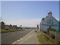
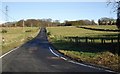
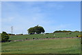
34 photos from this area
Area Information
Key information about the AB15 8PD including its size, population, and administrative classification.
- Area Type
- Postcode
- Area Size
- 33.9 hectares
- Population
- Not available
- Population Density
- Not available
House Prices in AB15 8PD
27
Properties
-
Average Sold Price
-
Lowest Price
-
Highest Price
Showing 27 properties
| Address | Type | Beds | Baths | Last Sale Price | Last Sale Date | |
|---|---|---|---|---|---|---|
| Shop, Five Mile House, Skene Road, Aberdeen, AB15 8PD | retail_financial | - | - | - | - | |
| Post Office House, Skene Road, Aberdeen, AB15 8PD | house | - | - | - | - | |
| 4A, Five Mile Caravan Park, Skene Road, Aberdeen, AB15 8PD | Detached | - | - | - | - | |
| 11, Five Mile Caravan Park, Skene Road, Aberdeen, AB15 8PD | Mobile Home | - | - | - | - | |
| Five Mile Caravan Park, Skene Road, Aberdeen, AB15 8PD | Leisure | - | - | - | - | |
| Five Mile House, Skene Road, Aberdeen, AB15 8PD | Retail | - | - | - | - | |
| George Gauld And Mrs Sheila Gauld, Filling Station, Five Mile House, Skene Road, Aberdeen, AB15 8PD | retail_financial | - | - | - | - | |
| Little Brodiach Cottage, Skene Road, Aberdeen, AB15 8PD | house | - | - | - | - | |
| Muirvale, Skene Road, Aberdeen, AB15 8PD | Detached | - | - | - | - | |
| Lynford House, Skene Road, Aberdeen, AB15 8PD | Detached | - | - | - | - |
Page 1 of 3
Energy Efficiency in AB15 8PD
Amenities
Schools
| Rank | School | Type | Entry gender | Ages |
|---|
Explore more schools in this area
Go to Schools tabDemographics
Household Size
N/A
most common
Accommodation Type
N/A
most common
Tenure
N/A
majority
Ethnic Group
N/A
most common
Religion
N/A
most common
Household Composition
N/A
most common
Age
N/A
median
N/A
most common
Household Deprivation
N/A
with no deprivation
NS-SEC
N/A
in Lower managerial occupations
Explore more demographic insights in this area
Go to Demographics tabPlanning
Planning Constraints
- Flood RiskPremium
- Ramsar Wetland SitesPremium
- Area of Outstanding Natural BeautyPremium
- Protected Nature ReservePremium
- Protected WoodlandPremium
- Crime RiskPremium