Area Overview for AB15 5NB
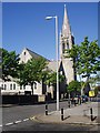
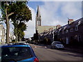
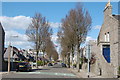
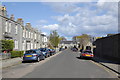
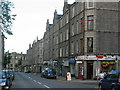
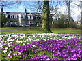
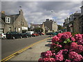
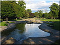
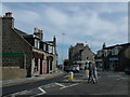
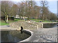
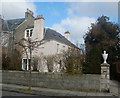
Photos of AB15 5NB

Area Information
AB15 5NB represents a specific postcode area covering a small residential cluster within the wider city of Aberdeen. This urban environment is part of Aberdeen City council area, situated astride the Rivers Dee and Don on the North Sea coast. The cluster spans approximately 2,170 square metres, forming a distinct pocket within the historic royal burgh known as the Granite City. You live here in a zone defined by its proximity to Europe's offshore oil capital, where the economy is driven by the energy sector alongside higher education. The character of the location blends the grit of traditional industries like fishing and shipbuilding with the modern influence of the North Sea oil industry that transformed the city since 1969. Daily life for residents involves navigating an area that has evolved from separate settlements, such as Old Aberdeen and New Aberdeen, into a unified urban hub. You benefit from being near significant landmarks including St. Machar's Cathedral, begun in 1424, and the ancient Brig o' Balgownie bridge from 1320. The area suits those who value connectivity, as you are situated close to key transport hubs including a major seaport and the Aberdeen Heliport. While the immediate postcode area is compact, the surrounding city offers a strategic coastal position that supports trade, education, and energy sectors. Living in AB15 5NB means residing in a place where prehistoric activity dating back 8,000 years layers beneath modern urban development and granite architecture.
- Area Type
- Postcode
- Area Size
- 2170 m²
- Population
- Not available
- Population Density
- Not available
The housing stock in AB15 5NB is part of a small residential cluster, yet the surrounding area of Aberdeen contains a significant variety of property types due to its status as a university town and energy hub. While specific figures for home ownership percentages or the exact ratio of flats to houses in this postcode are not available, the wider city hosts a mix of traditional granite architecture and modern developments. You are entering a market where the character of the "Granite City" defines much of the housing, particularly in older sections built between the 18th and 20th centuries. The presence of the University of Aberdeen ensures there is likely a steady demand for rental accommodations, balancing the market against owner-occupied homes. For buyers looking at this small area, the compact size of 2,170 square metres suggests a dense concentration of dwellings rather than sprawling estates. This density is typical of urban clusters near the Rivers Dee and Don. The property market here mirrors the city's economic drivers, with potential for properties near industrial and educational zones. Historical events, such as the boundary expansions in 1891 which included areas like Woodside and Torry, have layered different property types into the local landscape over time. You might find a mix of converted industrial spaces, standard urban flats, or terraced housing depending on your search within the immediate surroundings. The market is influenced by the North Sea oil industry, which continues to drive demand for housing in and around Aberdeen. Understanding the local economy is as important as the physical houses when making a purchase decision in this postcode.
House Prices in AB15 5NB
Showing 25 properties
| Address | Type | Beds | Baths | Last Sale Price | Last Sale Date | |
|---|---|---|---|---|---|---|
| Flat F, 8 Hosefield Road, Aberdeen, AB15 5NB | Flat | - | - | - | - | |
| Flat D, 6 Hosefield Road, Aberdeen, AB15 5NB | Flat | - | - | - | - | |
| Flat E, 4 Hosefield Road, Aberdeen, AB15 5NB | Flat | - | - | - | - | |
| Flat A, 8 Hosefield Road, Aberdeen, AB15 5NB | Flat | - | - | - | - | |
| Flat C, 8 Hosefield Road, Aberdeen, AB15 5NB | Flat | - | - | - | - | |
| Flat E, 6 Hosefield Road, Aberdeen, AB15 5NB | Flat | - | - | - | - | |
| Flat B, 10 Hosefield Road, Aberdeen, AB15 5NB | Flat | - | - | - | - | |
| 12 Hosefield Road, Aberdeen, AB15 5NB | house | - | - | - | - | |
| Flat E, 8 Hosefield Road, Aberdeen, AB15 5NB | Flat | - | - | - | - | |
| Flat F, 6 Hosefield Road, Aberdeen, AB15 5NB | Flat | - | - | - | - |
Energy Efficiency in AB15 5NB
Living in AB15 5NB offers immediate access to a range of amenities within practical reach. For your daily shopping needs, five retail venues are available, including Spar, Co-op Rosemount, and Co-op Fountainhall. These supermarkets provide the essentials for managing your household. Your commuting options are robust, supported by three rail stations and two airports in the immediate area. You can travel via Aberdeen Railway Station, Dyce Railway Station, or Portlethen Railway Station if needed beyond local buses. Air travel is facilitated by Aberdeen Dyce Airport and Aberdeen Airport, offering quick departures for domestic and international flights. Sea transport is accessible through Aberdeen Ferry Terminal, one of the key facilities for north-east Scotland connections. The area sits near the major seaport, the largest in the region, which also serves the local economy. While parks and leisure centres are not explicitly named in the data for this specific postcode, the location within Aberdeen City council area implies proximity to the city's known amenities like sea walls, golf courses, and the hidden beaches. The character of the area is enhanced by nearby landmarks such as St. Machar's Cathedral and the Brig o' Balgownie, which offer local interest and walkability. The retail and transport options create a convenient lifestyle where you can run errands, catch a train, or fly away without needing a vehicle for every trip. The mix of high street brands like Co-op and essential retailers ensures you never lack for basic goods.
Amenities
Schools
| Rank | School | Type | Entry gender | Ages |
|---|
Explore more schools in this area
Go to Schools tabDemographics
The demographic profile of AB15 5NB reflects the broader urban nature of Aberdeen, though specific data for this small 2,170 square metre cluster is not provided in the source information. Without precise figures for households, age distribution, or diversity within this specific postcode, it is impossible to state the exact composition of the community you would join. However, the wider Aberdeen area functions as an urban city with a university-town atmosphere, suggesting a population mix influenced by the University of Aberdeen and the offshore oil workforce. The city's history, dating back at least 8,000 years, has shaped a diverse social landscape that includes residents connected to the academic and energy sectors. In lieu of specific deprivation or home ownership statistics for this postcode, the area sits within a city that has traditionally served fishing, paper-making, and textiles before shifting focus. This economic shift since 1969 has likely influenced who resides in the smaller residential clusters of the city. You should expect a community shaped by the strategic coastal position that supports trade and energy. The size of the residential cluster suggests a tight-knit group of neighbours rather than a sprawling suburban district. While you cannot see specific numbers for income or age without more granular data, the location's identity as part of the Granite City informs the social fabric. Residents here likely interact with a population that has deep roots in the city's transformation from a medieval burgh to a modern industrial centre. The absence of detailed demographic breakdowns for this specific postcode means you must rely on the general urban character of Aberdeen to understand your neighbours.
Household Size
Accommodation Type
Tenure
Ethnic Group
Religion
Household Composition
Age
Household Deprivation
NS-SEC
Explore more demographic insights in this area
Go to Demographics tabPlanning
Planning Constraints
- Flood RiskPremium
- Ramsar Wetland SitesPremium
- Area of Outstanding Natural BeautyPremium
- Protected Nature ReservePremium
- Protected WoodlandPremium
- Crime & SafetyPremium