Area Overview for AB10 1RG
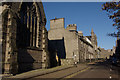
Photos of AB10 1RG


Area Information
Living in AB10 1RG means residing within a small residential cluster of 1.8 hectares in Aberdeen. This postcode serves as a compact pocket of suburbia in a city defined by its granite architecture and role as Europe's offshore oil capital. The area sits astride the North Sea coast, within the Aberdeen City council area. You move into a part of a historic royal burgh that originated as two separate settlements on the Rivers Dee and Don. The landscape here is distinctly urban, shaped by centuries of trade, education, and energy sector growth. Since the North Sea oil industry transformed the region in 1969, the city has evolved from traditional sectors like fishing and textiles into a modern economic hub. You are located in a space where the legacy of St. Machar and the University of Aberdeen permeates the daily character of the neighbourhood. The compact nature of this 1.8-hectare site means you are surrounded by wider city development yet remain in a defined residential setting. Residents enjoy the strategic coastal position that supports diverse industries while maintaining a connection to the historic core. The area reflects Aberdeen's unique blend of ancient heritage and modern industrial ambition, offering a practical living environment for families and professionals alike.
- Area Type
- Postcode
- Area Size
- 1.8 hectares
- Population
- Not available
- Population Density
- Not available
The property market in AB10 1RG is characterised by a high volume of owner-occupied residences. With 92 per cent of households classified as owner-occupied, this postcode represents a stable investment environment for those seeking a long-term foothold in Aberdeen. The housing stock is overwhelmingly dominated by detached houses, which make up 87 per cent of all accommodation types in this 1.8-hectare cluster. This dominance suggests a lower density residential setting compared to town centre locations, potentially offering more privacy and space. Only 8 per cent of homes are terraced, with semi-detached and flat options comprising just 2.9 per cent and 2.5 per cent respectively. This distribution indicates that buyers looking for traditional suburban living will find the majority of available properties to suit their requirements. The market reflects a preference for standing ownership, reducing the prevalence of tenant-led occupancy clusters found in denser urban zones. Prospective buyers can expect a consistent stock of family-sized detached dwellings that have served the community for decades. The high concentration of owner-occupied homes often correlates with better-maintained properties and a neighbourhood where long-term residents have a vested interest in local stability.
House Prices in AB10 1RG
Showing 1 properties
| Address | Type | Beds | Baths | Last Sale Price | Last Sale Date | |
|---|---|---|---|---|---|---|
| Harlaw Academy, 18-20 Albyn Place, Aberdeen, AB10 1RG | commercial | - | - | - | - |
Energy Efficiency in AB10 1RG
Living in AB10 1RG places you within easy reach of major retail, transport, and leisure facilities in Aberdeen. You have access to five key retail outlets, including Sainsburys Aberdeen and Tesco Aberdeen, ensuring daily shopping needs are met without extensive travel. Transport options are extensive, with three railway stations, one ferry terminal, and two airports within practical reach. The Aberdeen Railway Station offers direct services to Edinburgh and Glasgow, while Aberdeen Ferry Terminal provides sea connections to Inverness and the Shetland Islands. Residents can travel to Aberdeen Dyce Airport or Aberdeen Airport for air travel. Beyond these major hubs, the area benefits from the city's historic landmarks, including St. Machar's Cathedral, King's College, and Marischal College. St. Machar's Cathedral, which began construction in 1424, stands as a key historical feature alongside the Brig o' Balgownie and Old Bridge of Dee. The commercial Castlegate area offers further retail and dining opportunities. The local economy, driven by the offshore oil industry since 1969, supports numerous jobs in energy, education, and public services. The presence of the University of Aberdeen adds an intellectual vibrancy to the community. Your daily life is supported by a network of amenities that bridge historic tradition with modern commercial convenience.
Amenities
Schools
| Rank | School | Type | Entry gender | Ages |
|---|
Explore more schools in this area
Go to Schools tabDemographics
The community profile for AB10 1RG reflects the wider demographics of the city it serves. Available data indicates that the area contains 29,650 households across 68,420 residents. This results in an average household size of 2.3 people per household. More than half of all households, specifically 58.3 per cent, consist of just one person. This statistic suggests a significant population of single professionals or empty-nesters within the neighbourhood. Approximately 92 per cent of households are classified as owner-occupied, establishing this environment as a stable, long-term residence rather than a transient rental market. The housing stock is predominantly detached houses, making up 87 per cent of the total accommodation type. Terraced homes are far less common, accounting for only 8 per cent. Semi-detached properties represent 2.9 per cent of the dwellings, while flats comprise a minor 2.5 per cent. In terms of diversity, the resident population is 85 per cent British. The area does not currently have specific data on deprivation levels, but the high rate of home ownership often points to established, financially secure households. The physical structure of homes mirrors a traditional suburban pattern common in parts of Scotland.
Household Size
Accommodation Type
Tenure
Ethnic Group
Religion
Household Composition
Age
Household Deprivation
NS-SEC
Explore more demographic insights in this area
Go to Demographics tabPlanning
Planning Constraints
- Flood RiskPremium
- Ramsar Wetland SitesPremium
- Area of Outstanding Natural BeautyPremium
- Protected Nature ReservePremium
- Protected WoodlandPremium
- Crime & SafetyPremium