Area Overview for YO32 5UQ
Photos of YO32 5UQ

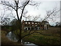


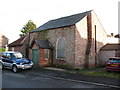


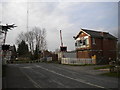

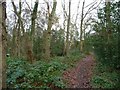
57 photos from this area
Area Information
Key information about the YO32 5UQ including its size, population, and administrative classification.
- Area Type
- Postcode
- Area Size
- 3.2 hectares
- Population
- 1399
- Population Density
- 188 people/km²
House Prices in YO32 5UQ
32
Properties
£368,725
Average Sold Price
£38,500
Lowest Price
£1,425,000
Highest Price
Showing 32 properties
| Address | Type | Beds | Baths | Last Sale Price | Last Sale Date | |
|---|---|---|---|---|---|---|
| The Oak, 46 Moor Lane, Strensall, York, YO32 5UQ | Detached | 5 | 3 | £700,000 | Mar 2025 | |
| 52 Moor Lane, Strensall, York, YO32 5UQ | Bungalow | 2 | 1 | £395,000 | Sep 2023 | |
| The Hollies, 48 Moor Lane, Strensall, York, YO32 5UQ | house | - | - | £550,000 | Jan 2020 | |
| The Oaks, 54A Moor Lane, Strensall, York, YO32 5UQ | Detached | 5 | 2 | £655,000 | Jun 2019 | |
| Goldsborough Manor, 10-12 Moor Lane, Strensall, York, YO32 5UQ | hospital_care_home | - | - | £1,425,000 | Nov 2018 | |
| 60 Moor Lane, Strensall, York, YO32 5UQ | Detached | 5 | 2 | £450,000 | Jul 2018 | |
| 42 Moor Lane, Strensall, York, YO32 5UQ | Semi-detached | 2 | - | £185,000 | Jun 2014 | |
| Rose Dene, Moor Lane, Strensall, York, YO32 5UQ | house | - | - | £550,000 | Feb 2011 | |
| 6 Moor Lane, Strensall, York, YO32 5UQ | house | - | - | £439,000 | Dec 2010 | |
| Broadlands, Moor Lane, Strensall, York, YO32 5UQ | house | - | - | £460,000 | Oct 2010 |
Page 1 of 4
Energy Efficiency in YO32 5UQ
Amenities
Schools
| Rank | School | Type | Entry gender | Ages |
|---|
Explore more schools in this area
Go to Schools tabDemographics
Household Size
Family (3-5 people)
most common
Accommodation Type
Houses
most common
Tenure
90
majority
Ethnic Group
White
most common
Religion
N/A
most common
Household Composition
N/A
most common
Age
47
median
Adults (30-64 years)
most common
Household Deprivation
N/A
with no deprivation
NS-SEC
50
in Lower managerial occupations
Explore more demographic insights in this area
Go to Demographics tabPlanning
Planning Constraints
- Flood RiskPremium
- Ramsar Wetland SitesPremium
- Area of Outstanding Natural BeautyPremium
- Protected Nature ReservePremium
- Protected WoodlandPremium