Area Overview for YO32 5TE
Photos of YO32 5TE
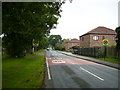
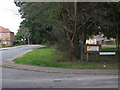
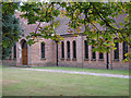
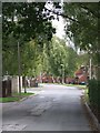
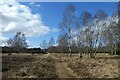
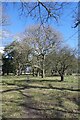
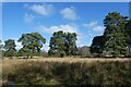
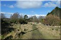
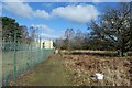
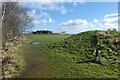
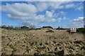
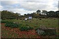
34 photos from this area
Area Information
Key information about the YO32 5TE including its size, population, and administrative classification.
- Area Type
- Postcode
- Area Size
- 2.2 hectares
- Population
- 1830
- Population Density
- 1035 people/km²
House Prices in YO32 5TE
26
Properties
£351,353
Average Sold Price
£93,000
Lowest Price
£715,000
Highest Price
Showing 26 properties
| Address | Type | Beds | Baths | Last Sale Price | Last Sale Date | |
|---|---|---|---|---|---|---|
| 10 Oak Tree Close, Strensall, York, YO32 5TE | Detached | 5 | 4 | £715,000 | Mar 2025 | |
| 12 Oak Tree Close, Strensall, York, YO32 5TE | Detached | 4 | 2 | £490,000 | Feb 2024 | |
| 27 Oak Tree Close, Strensall, York, YO32 5TE | house | - | - | £550,000 | Mar 2023 | |
| 5 Oak Tree Close, Strensall, York, YO32 5TE | house | 3 | - | £435,000 | Sep 2020 | |
| 3 Oak Tree Close, Strensall, York, YO32 5TE | Detached | 4 | 2 | £450,000 | Jul 2019 | |
| 2 Oak Tree Close, Strensall, York, YO32 5TE | Detached | 4 | - | £425,000 | Aug 2018 | |
| 9 Oak Tree Close, Strensall, York, YO32 5TE | Detached | 3 | 1 | £334,000 | Jul 2017 | |
| 8 Oak Tree Close, Strensall, York, YO32 5TE | Detached | 4 | 3 | £360,000 | Apr 2015 | |
| Greenaway, 11 Oak Tree Close, Strensall, York, YO32 5TE | Detached | 4 | - | £391,000 | Nov 2014 | |
| 1 Oak Tree Close, Strensall, York, YO32 5TE | Detached | 5 | - | £540,000 | Apr 2014 |
Page 1 of 3
Energy Efficiency in YO32 5TE
Amenities
Schools
| Rank | School | Type | Entry gender | Ages |
|---|
Explore more schools in this area
Go to Schools tabDemographics
Household Size
Two person
most common
Accommodation Type
Houses
most common
Tenure
87
majority
Ethnic Group
White
most common
Religion
N/A
most common
Household Composition
N/A
most common
Age
47
median
Adults (30-64 years)
most common
Household Deprivation
N/A
with no deprivation
NS-SEC
39
in Lower managerial occupations
Explore more demographic insights in this area
Go to Demographics tabPlanning
Planning Constraints
- Flood RiskPremium
- Ramsar Wetland SitesPremium
- Area of Outstanding Natural BeautyPremium
- Protected Nature ReservePremium
- Protected WoodlandPremium