Area Overview for YO21 3SU
Photos of YO21 3SU

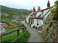
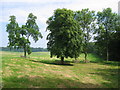
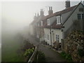
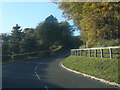


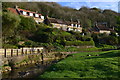
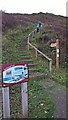
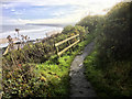
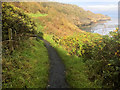
89 photos from this area
Area Information
Key information about the YO21 3SU including its size, population, and administrative classification.
- Area Type
- Postcode
- Area Size
- 23.2 hectares
- Population
- 1285
- Population Density
- 21 people/km²
House Prices in YO21 3SU
48
Properties
£389,418
Average Sold Price
£90,000
Lowest Price
£1,200,000
Highest Price
Showing 48 properties
| Address | Type | Beds | Baths | Last Sale Price | Last Sale Date | |
|---|---|---|---|---|---|---|
| Hart Cottage, East Row, Sandsend, YO21 3SU | Detached | - | - | £360,000 | Nov 2022 | |
| Ness View, East Row, Sandsend, YO21 3SU | Detached | 3 | 1 | £742,601 | Sep 2022 | |
| Briar Cottage, East Row, Sandsend, YO21 3SU | house | - | - | £555,500 | Nov 2021 | |
| Thordisa House, East Row, Sandsend, YO21 3SU | Cottage | 5 | 4 | £1,200,000 | Feb 2021 | |
| Haywood, East Row, Sandsend, YO21 3SU | house | - | - | £440,000 | Sep 2020 | |
| Field Cottage, East Row, Sandsend, YO21 3SU | Cottage | 3 | 1 | £470,000 | Mar 2020 | |
| 2, Railway Cottages, East Row, Sandsend, YO21 3SU | house | - | - | £270,000 | Apr 2017 | |
| Norwood, East Row, Sandsend, YO21 3SU | Terraced | 4 | 2 | £425,000 | Dec 2014 | |
| Beach Cottage, East Row, Sandsend, YO21 3SU | house | - | - | £529,250 | Feb 2013 | |
| 1, Railway Cottages, East Row, Sandsend, YO21 3SU | house | - | - | £270,000 | Sep 2012 |
Page 1 of 5
Energy Efficiency in YO21 3SU
Amenities
Schools
| Rank | School | Type | Entry gender | Ages |
|---|
Explore more schools in this area
Go to Schools tabDemographics
Household Size
Two person
most common
Accommodation Type
Houses
most common
Tenure
63
majority
Ethnic Group
White
most common
Religion
N/A
most common
Household Composition
N/A
most common
Age
47
median
Adults (30-64 years)
most common
Household Deprivation
N/A
with no deprivation
NS-SEC
32
in Lower managerial occupations
Explore more demographic insights in this area
Go to Demographics tabPlanning
Planning Constraints
- Flood RiskPremium
- Ramsar Wetland SitesPremium
- Area of Outstanding Natural BeautyPremium
- Protected Nature ReservePremium
- Protected WoodlandPremium