Area Overview for YO19 5SQ
Photos of YO19 5SQ


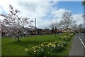
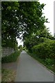
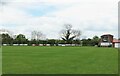
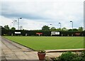


36 photos from this area
Area Information
Key information about the YO19 5SQ including its size, population, and administrative classification.
- Area Type
- Postcode
- Area Size
- 7034 m²
- Population
- 1924
- Population Density
- 64 people/km²
House Prices in YO19 5SQ
17
Properties
£134,405
Average Sold Price
£42,500
Lowest Price
£295,000
Highest Price
Showing 17 properties
| Address | Type | Beds | Baths | Last Sale Price | Last Sale Date | |
|---|---|---|---|---|---|---|
| 10 Keepers Way, Dunnington, York, YO19 5SQ | house | - | - | £168,000 | Jul 2020 | |
| 11 Keepers Way, Dunnington, York, YO19 5SQ | house | - | - | £77,000 | Apr 2016 | |
| 7 Keepers Way, Dunnington, York, YO19 5SQ | Detached | - | - | £295,000 | Apr 2014 | |
| 16 Keepers Way, Dunnington, York, YO19 5SQ | house | 2 | - | £80,000 | Oct 2013 | |
| 12 Keepers Way, Dunnington, York, YO19 5SQ | house | 2 | - | £140,000 | Oct 2007 | |
| 4 Keepers Way, Dunnington, York, YO19 5SQ | Detached | - | - | £285,000 | Oct 2006 | |
| 15 Keepers Way, Dunnington, York, YO19 5SQ | Semi-detached | - | - | £67,500 | Dec 2004 | |
| 14 Keepers Way, Dunnington, York, YO19 5SQ | house | - | - | £42,500 | Sep 2001 | |
| 1 Keepers Way, Dunnington, York, YO19 5SQ | house | - | - | £118,500 | Feb 1998 | |
| 6 Keepers Way, Dunnington, York, YO19 5SQ | Detached | - | - | £125,000 | Jun 1997 |
Page 1 of 2
Energy Efficiency in YO19 5SQ
Amenities
Schools
| Rank | School | Type | Entry gender | Ages |
|---|
Explore more schools in this area
Go to Schools tabDemographics
Household Size
Two person
most common
Accommodation Type
Houses
most common
Tenure
88
majority
Ethnic Group
White
most common
Religion
N/A
most common
Household Composition
N/A
most common
Age
47
median
Adults (30-64 years)
most common
Household Deprivation
N/A
with no deprivation
NS-SEC
44
in Lower managerial occupations
Explore more demographic insights in this area
Go to Demographics tabPlanning
Planning Constraints
- Flood RiskPremium
- Ramsar Wetland SitesPremium
- Area of Outstanding Natural BeautyPremium
- Protected Nature ReservePremium
- Protected WoodlandPremium