Area Overview for YO19 5SL
Photos of YO19 5SL


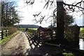

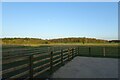

36 photos from this area
Area Information
Key information about the YO19 5SL including its size, population, and administrative classification.
- Area Type
- Postcode
- Area Size
- 1.8 hectares
- Population
- 1924
- Population Density
- 64 people/km²
House Prices in YO19 5SL
32
Properties
£277,859
Average Sold Price
£89,500
Lowest Price
£507,500
Highest Price
Showing 32 properties
| Address | Type | Beds | Baths | Last Sale Price | Last Sale Date | |
|---|---|---|---|---|---|---|
| 37 Kerver Lane, Dunnington, York, YO19 5SL | house | - | - | £495,000 | Sep 2021 | |
| Santosa, 33 Kerver Lane, Dunnington, York, YO19 5SL | Detached | 4 | 1 | £507,500 | Jan 2021 | |
| Kappelan, 35 Kerver Lane, Dunnington, York, YO19 5SL | house | - | - | £500,000 | Nov 2020 | |
| 31 Kerver Lane, Dunnington, York, YO19 5SL | Detached | 5 | 1 | £455,000 | Sep 2017 | |
| 61 Kerver Lane, Dunnington, York, YO19 5SL | house | - | - | £295,000 | Jun 2014 | |
| Bailliewood, 9 Kerver Lane, Dunnington, York, YO19 5SL | Detached | 4 | 2 | £385,000 | Feb 2014 | |
| 29 Kerver Lane, Dunnington, York, YO19 5SL | house | - | - | £283,750 | Jul 2009 | |
| Thamesdale, 11 Kerver Lane, Dunnington, York, YO19 5SL | Detached | - | - | £299,000 | Nov 2007 | |
| 51 Kerver Lane, Dunnington, York, YO19 5SL | Detached | - | - | £280,000 | Nov 2006 | |
| 41 Kerver Lane, Dunnington, York, YO19 5SL | Detached | 4 | 2 | £422,500 | May 2005 |
Page 1 of 4
Energy Efficiency in YO19 5SL
Amenities
Schools
| Rank | School | Type | Entry gender | Ages |
|---|
Explore more schools in this area
Go to Schools tabDemographics
Household Size
Two person
most common
Accommodation Type
Houses
most common
Tenure
88
majority
Ethnic Group
White
most common
Religion
N/A
most common
Household Composition
N/A
most common
Age
47
median
Adults (30-64 years)
most common
Household Deprivation
N/A
with no deprivation
NS-SEC
44
in Lower managerial occupations
Explore more demographic insights in this area
Go to Demographics tabPlanning
Planning Constraints
- Flood RiskPremium
- Ramsar Wetland SitesPremium
- Area of Outstanding Natural BeautyPremium
- Protected Nature ReservePremium
- Protected WoodlandPremium