Area Overview for YO18 7QG
Photos of YO18 7QG
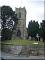
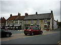
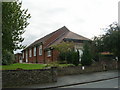
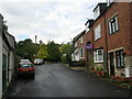
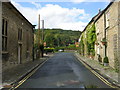
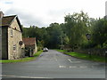
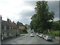
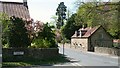
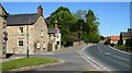
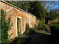
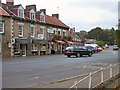
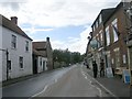
100 photos from this area
Area Information
Key information about the YO18 7QG including its size, population, and administrative classification.
- Area Type
- Postcode
- Area Size
- 9451 m²
- Population
- 1742
- Population Density
- 57 people/km²
House Prices in YO18 7QG
9
Properties
£389,571
Average Sold Price
£76,000
Lowest Price
£805,000
Highest Price
Showing 9 properties
| Address | Type | Beds | Baths | Last Sale Price | Last Sale Date | |
|---|---|---|---|---|---|---|
| Sleepy Hollow, Rectory Lane, Thornton Le Dale, YO18 7QG | house | - | - | £805,000 | Mar 2023 | |
| Rectory House, Rectory Lane, Thornton Le Dale, YO18 7QG | house | - | - | £760,000 | Mar 2022 | |
| Bankfield, Rectory Lane, Thornton Le Dale, YO18 7QG | Semi-detached | 3 | 1 | £285,000 | Jul 2020 | |
| Briardene, Rectory Lane, Thornton Le Dale, YO18 7QG | Semi-detached | 3 | - | £216,000 | Jul 2017 | |
| The Pippins, Rectory Lane, Thornton Le Dale, YO18 7QG | house | - | - | £350,000 | Jun 2011 | |
| Honeysuckle Cottage, Rectory Lane, Thornton Le Dale, YO18 7QG | Semi-detached | - | - | £235,000 | Oct 2001 | |
| Harefield, Rectory Lane, Thornton Le Dale, YO18 7QG | Semi-detached | - | - | £76,000 | Aug 1999 | |
| Witney, Rectory Lane, Thornton Le Dale, YO18 7QG | Semi-detached | - | - | - | - | |
| The Stables, Church Hill, Thornton Le Dale, YO18 7QG | Terraced | 3 | 1 | - | - |
Energy Efficiency in YO18 7QG
Amenities
Schools
| Rank | School | Type | Entry gender | Ages |
|---|
Explore more schools in this area
Go to Schools tabDemographics
Household Size
Two person
most common
Accommodation Type
Houses
most common
Tenure
79
majority
Ethnic Group
White
most common
Religion
N/A
most common
Household Composition
N/A
most common
Age
47
median
Elderly (65+ years)
most common
Household Deprivation
N/A
with no deprivation
NS-SEC
38
in Lower managerial occupations
Explore more demographic insights in this area
Go to Demographics tabPlanning
Planning Constraints
- Flood RiskPremium
- Ramsar Wetland SitesPremium
- Area of Outstanding Natural BeautyPremium
- Protected Nature ReservePremium
- Protected WoodlandPremium