Area Overview for WF9 1JF
Photos of WF9 1JF
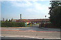
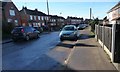
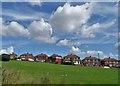
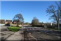
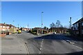
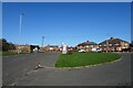
20 photos from this area
Area Information
Key information about the WF9 1JF including its size, population, and administrative classification.
- Area Type
- Postcode
- Area Size
- 1.1 hectares
- Population
- 1416
- Population Density
- 294 people/km²
House Prices in WF9 1JF
26
Properties
£89,660
Average Sold Price
£25,000
Lowest Price
£165,000
Highest Price
Showing 26 properties
| Address | Type | Beds | Baths | Last Sale Price | Last Sale Date | |
|---|---|---|---|---|---|---|
| 30 Walton Road, Upton, Pontefract, WF9 1JF | Terraced | 4 | 1 | £155,000 | Apr 2025 | |
| 48 Walton Road, Upton, Pontefract, WF9 1JF | house | 3 | 1 | £116,000 | Jul 2022 | |
| 24 Walton Road, Upton, Pontefract, WF9 1JF | Bungalow | 2 | 1 | £165,000 | Jan 2022 | |
| 60 Walton Road, Upton, Pontefract, WF9 1JF | Terraced | 3 | 1 | £110,000 | Nov 2019 | |
| 50 Walton Road, Upton, Pontefract, WF9 1JF | Semi-detached | 4 | 1 | £67,500 | Dec 2016 | |
| 62 Walton Road, Upton, Pontefract, WF9 1JF | Semi-detached | 3 | 2 | £87,000 | Jan 2016 | |
| 40 Walton Road, Upton, Pontefract, WF9 1JF | Terraced | 3 | 1 | £90,000 | Dec 2007 | |
| 38 Walton Road, Upton, Pontefract, WF9 1JF | house | - | - | £73,200 | Feb 2007 | |
| 46 Walton Road, Upton, Pontefract, WF9 1JF | Semi-detached | 4 | 1 | £67,500 | Jul 2006 | |
| 68 Walton Road, Upton, Pontefract, WF9 1JF | Terraced | 3 | 1 | £94,725 | May 2006 |
Page 1 of 3
Energy Efficiency in WF9 1JF
Amenities
Schools
| Rank | School | Type | Entry gender | Ages |
|---|
Explore more schools in this area
Go to Schools tabDemographics
Household Size
Two person
most common
Accommodation Type
Houses
most common
Tenure
73
majority
Ethnic Group
White
most common
Religion
N/A
most common
Household Composition
N/A
most common
Age
47
median
Adults (30-64 years)
most common
Household Deprivation
N/A
with no deprivation
NS-SEC
17
in Lower managerial occupations
Explore more demographic insights in this area
Go to Demographics tabPlanning
Planning Constraints
- Flood RiskPremium
- Ramsar Wetland SitesPremium
- Area of Outstanding Natural BeautyPremium
- Protected Nature ReservePremium
- Protected WoodlandPremium