Area Overview for WF9 1EL
Photos of WF9 1EL
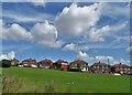
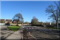
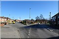
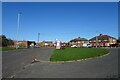
20 photos from this area
Area Information
Key information about the WF9 1EL including its size, population, and administrative classification.
- Area Type
- Postcode
- Area Size
- 1.0 hectares
- Population
- 1416
- Population Density
- 294 people/km²
House Prices in WF9 1EL
22
Properties
£58,258
Average Sold Price
£15,595
Lowest Price
£120,000
Highest Price
Showing 22 properties
| Address | Type | Beds | Baths | Last Sale Price | Last Sale Date | |
|---|---|---|---|---|---|---|
| 16 Graham Avenue, Upton, Pontefract, WF9 1EL | house | - | - | £105,000 | Jan 2021 | |
| 21 Graham Avenue, Upton, Pontefract, WF9 1EL | house | - | - | £120,000 | Nov 2018 | |
| 15 Graham Avenue, Upton, Pontefract, WF9 1EL | Semi-detached | 3 | 1 | £70,000 | Jan 2018 | |
| 4 Graham Avenue, Upton, Pontefract, WF9 1EL | Semi-detached | 3 | 2 | £95,000 | Nov 2017 | |
| 9 Graham Avenue, Upton, Pontefract, WF9 1EL | Terraced | 3 | - | £77,000 | Dec 2016 | |
| 20 Graham Avenue, Upton, Pontefract, WF9 1EL | Semi-detached | - | - | £90,000 | Mar 2005 | |
| 13 Graham Avenue, Upton, Pontefract, WF9 1EL | Semi-detached | - | - | £34,000 | May 2002 | |
| 5 Graham Avenue, Upton, Pontefract, WF9 1EL | house | - | - | £22,000 | May 2001 | |
| 14 Graham Avenue, Upton, Pontefract, WF9 1EL | Semi-detached | 3 | 1 | £32,000 | Jun 1997 | |
| 19 Graham Avenue, Upton, Pontefract, WF9 1EL | Semi-detached | - | - | £20,000 | May 1997 |
Page 1 of 3
Energy Efficiency in WF9 1EL
Amenities
Schools
| Rank | School | Type | Entry gender | Ages |
|---|
Explore more schools in this area
Go to Schools tabDemographics
Household Size
Two person
most common
Accommodation Type
Houses
most common
Tenure
73
majority
Ethnic Group
White
most common
Religion
N/A
most common
Household Composition
N/A
most common
Age
47
median
Adults (30-64 years)
most common
Household Deprivation
N/A
with no deprivation
NS-SEC
17
in Lower managerial occupations
Explore more demographic insights in this area
Go to Demographics tabPlanning
Planning Constraints
- Flood RiskPremium
- Ramsar Wetland SitesPremium
- Area of Outstanding Natural BeautyPremium
- Protected Nature ReservePremium
- Protected WoodlandPremium