Area Overview for WF4 2DB
Photos of WF4 2DB
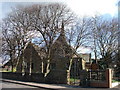
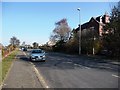
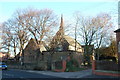
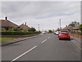
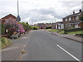
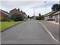
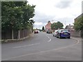
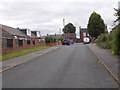
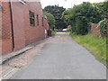
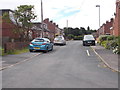
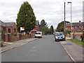
64 photos from this area
Area Information
Key information about the WF4 2DB including its size, population, and administrative classification.
- Area Type
- Postcode
- Area Size
- 2.7 hectares
- Population
- 1637
- Population Density
- 1432 people/km²
House Prices in WF4 2DB
25
Properties
£121,389
Average Sold Price
£20,000
Lowest Price
£280,000
Highest Price
Showing 25 properties
| Address | Type | Beds | Baths | Last Sale Price | Last Sale Date | |
|---|---|---|---|---|---|---|
| 26 Nostell Lane, Ryhill, Wakefield, WF4 2DB | house | 4 | 3 | £236,000 | Jun 2024 | |
| 1 Nostell Lane, Ryhill, Wakefield, WF4 2DB | house | - | - | £280,000 | Nov 2022 | |
| 14 Nostell Lane, Ryhill, Wakefield, WF4 2DB | house | - | - | £118,000 | Jul 2022 | |
| 5B Nostell Lane, Ryhill, Wakefield, WF4 2DB | Bungalow | - | - | £107,500 | Aug 2012 | |
| 3 Nostell Lane, Ryhill, Wakefield, WF4 2DB | Semi-detached | - | - | £186,000 | Dec 2007 | |
| 6 Nostell Lane, Ryhill, Wakefield, WF4 2DB | Terraced | 2 | 1 | £70,000 | Dec 2003 | |
| 5A Nostell Lane, Ryhill, Wakefield, WF4 2DB | Semi-detached | - | - | £40,000 | Jun 2001 | |
| 28 Nostell Lane, Ryhill, Wakefield, WF4 2DB | Terraced | - | - | £35,000 | Jan 2001 | |
| 18 Nostell Lane, Ryhill, Wakefield, WF4 2DB | Terraced | - | - | £20,000 | Jul 1998 | |
| 22 Nostell Lane, Ryhill, Wakefield, WF4 2DB | Terraced | 3 | 2 | - | - |
Page 1 of 3
Energy Efficiency in WF4 2DB
Amenities
Schools
| Rank | School | Type | Entry gender | Ages |
|---|
Explore more schools in this area
Go to Schools tabDemographics
Household Size
Two person
most common
Accommodation Type
Houses
most common
Tenure
75
majority
Ethnic Group
White
most common
Religion
N/A
most common
Household Composition
N/A
most common
Age
47
median
Adults (30-64 years)
most common
Household Deprivation
N/A
with no deprivation
NS-SEC
25
in Lower managerial occupations
Explore more demographic insights in this area
Go to Demographics tabPlanning
Planning Constraints
- Flood RiskPremium
- Ramsar Wetland SitesPremium
- Area of Outstanding Natural BeautyPremium
- Protected Nature ReservePremium
- Protected WoodlandPremium