Area Overview for WF3 1RX
Photos of WF3 1RX

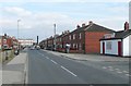
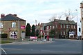
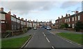
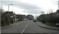
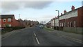
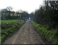

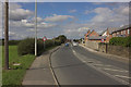

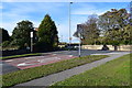
79 photos from this area
Area Information
Key information about the WF3 1RX including its size, population, and administrative classification.
- Area Type
- Postcode
- Area Size
- 1.4 hectares
- Population
- 1584
- Population Density
- 558 people/km²
House Prices in WF3 1RX
21
Properties
£115,965
Average Sold Price
£89,950
Lowest Price
£140,000
Highest Price
Showing 21 properties
| Address | Type | Beds | Baths | Last Sale Price | Last Sale Date | |
|---|---|---|---|---|---|---|
| 220 Bradford Road, Tingley, Wakefield, WF3 1RX | house | - | - | £140,000 | Jun 2025 | |
| 216 Bradford Road, Tingley, Wakefield, WF3 1RX | house | - | - | £113,000 | Apr 2025 | |
| 194 Bradford Road, Tingley, Wakefield, WF3 1RX | Semi-detached | 2 | 1 | £135,000 | Mar 2025 | |
| 212 Bradford Road, Tingley, Wakefield, WF3 1RX | house | - | - | £138,400 | Feb 2022 | |
| 218 Bradford Road, Tingley, Wakefield, WF3 1RX | house | - | - | £120,000 | Nov 2020 | |
| 230 Bradford Road, Tingley, Wakefield, WF3 1RX | Semi-detached | 2 | 1 | £122,500 | Sep 2019 | |
| 206 Bradford Road, Tingley, Wakefield, WF3 1RX | house | 2 | 1 | £120,000 | Oct 2017 | |
| 214 Bradford Road, Tingley, Wakefield, WF3 1RX | Semi-detached | 2 | 1 | £105,000 | Feb 2017 | |
| 232 Bradford Road, Tingley, Wakefield, WF3 1RX | Semi-detached | - | - | £97,750 | Jul 2016 | |
| 228 Bradford Road, Tingley, Wakefield, WF3 1RX | Semi-detached | 3 | 1 | £96,500 | Jun 2016 |
Page 1 of 3
Energy Efficiency in WF3 1RX
Amenities
Schools
| Rank | School | Type | Entry gender | Ages |
|---|
Explore more schools in this area
Go to Schools tabDemographics
Household Size
Two person
most common
Accommodation Type
Houses
most common
Tenure
64
majority
Ethnic Group
White
most common
Religion
N/A
most common
Household Composition
N/A
most common
Age
47
median
Adults (30-64 years)
most common
Household Deprivation
N/A
with no deprivation
NS-SEC
27
in Lower managerial occupations
Explore more demographic insights in this area
Go to Demographics tabPlanning
Planning Constraints
- Flood RiskPremium
- Ramsar Wetland SitesPremium
- Area of Outstanding Natural BeautyPremium
- Protected Nature ReservePremium
- Protected WoodlandPremium