Area Overview for WF3 1NW
Photos of WF3 1NW
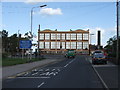
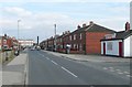
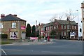
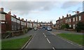
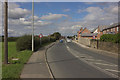
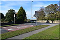
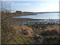
79 photos from this area
Area Information
Key information about the WF3 1NW including its size, population, and administrative classification.
- Area Type
- Postcode
- Area Size
- 2.1 hectares
- Population
- 1523
- Population Density
- 3916 people/km²
House Prices in WF3 1NW
56
Properties
£87,380
Average Sold Price
£25,230
Lowest Price
£211,000
Highest Price
Showing 56 properties
| Address | Type | Beds | Baths | Last Sale Price | Last Sale Date | |
|---|---|---|---|---|---|---|
| 28 Garden House Lane, West Ardsley, Wakefield, WF3 1NW | Terraced | 2 | 1 | £180,000 | Oct 2025 | |
| 30 Garden House Lane, West Ardsley, Wakefield, WF3 1NW | house | - | - | £140,500 | Aug 2021 | |
| 7 Garden House Lane, West Ardsley, Wakefield, WF3 1NW | Semi-detached | 3 | - | £85,000 | Mar 2016 | |
| 12 Garden House Lane, West Ardsley, Wakefield, WF3 1NW | Terraced | 2 | 1 | £94,000 | May 2013 | |
| 4 Garden House Lane, West Ardsley, Wakefield, WF3 1NW | house | 3 | - | £211,000 | Apr 2013 | |
| 42 Garden House Lane, West Ardsley, Wakefield, WF3 1NW | house | 2 | - | £95,760 | Apr 2012 | |
| 48 Garden House Lane, West Ardsley, Wakefield, WF3 1NW | house | - | - | £139,950 | Sep 2006 | |
| 22 Garden House Lane, West Ardsley, Wakefield, WF3 1NW | Terraced | - | - | £110,000 | May 2006 | |
| 36 Garden House Lane, West Ardsley, Wakefield, WF3 1NW | Terraced | - | - | £51,000 | Sep 2005 | |
| 10 Garden House Lane, West Ardsley, Wakefield, WF3 1NW | Terraced | - | - | £25,230 | Feb 2005 |
Page 1 of 6
Energy Efficiency in WF3 1NW
Amenities
Schools
| Rank | School | Type | Entry gender | Ages |
|---|
Explore more schools in this area
Go to Schools tabDemographics
Household Size
Family (3-5 people)
most common
Accommodation Type
Houses
most common
Tenure
52
majority
Ethnic Group
White
most common
Religion
N/A
most common
Household Composition
N/A
most common
Age
47
median
Adults (30-64 years)
most common
Household Deprivation
N/A
with no deprivation
NS-SEC
20
in Lower managerial occupations
Explore more demographic insights in this area
Go to Demographics tabPlanning
Planning Constraints
- Flood RiskPremium
- Ramsar Wetland SitesPremium
- Area of Outstanding Natural BeautyPremium
- Protected Nature ReservePremium
- Protected WoodlandPremium