Area Overview for WF3 1RL
Photos of WF3 1RL


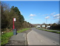
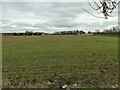
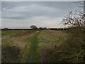
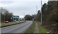
45 photos from this area
Area Information
Key information about the WF3 1RL including its size, population, and administrative classification.
- Area Type
- Postcode
- Area Size
- 2319 m²
- Population
- 1380
- Population Density
- 3897 people/km²
House Prices in WF3 1RL
11
Properties
£131,450
Average Sold Price
£46,000
Lowest Price
£265,000
Highest Price
Showing 11 properties
| Address | Type | Beds | Baths | Last Sale Price | Last Sale Date | |
|---|---|---|---|---|---|---|
| 19 Low Street, Tingley, Wakefield, WF3 1RL | Semi-detached | 4 | 2 | £265,000 | Feb 2024 | |
| 14 Low Street, Tingley, Wakefield, WF3 1RL | house | - | - | £155,000 | Jul 2022 | |
| 10 Low Street, Tingley, Wakefield, WF3 1RL | Terraced | 2 | 1 | £113,000 | Sep 2021 | |
| 12 Low Street, Tingley, Wakefield, WF3 1RL | Terraced | 2 | 1 | £116,000 | Jul 2020 | |
| 16 Low Street, Tingley, Wakefield, WF3 1RL | Terraced | 3 | 1 | £136,000 | Nov 2018 | |
| 23 Low Street, Tingley, Wakefield, WF3 1RL | Semi-detached | 2 | 1 | £132,500 | Apr 2017 | |
| 27 Low Street, Tingley, Wakefield, WF3 1RL | Detached | 3 | 1 | £185,000 | Feb 2015 | |
| 25 Low Street, Tingley, Wakefield, WF3 1RL | Semi-detached | 2 | - | £118,500 | Aug 2014 | |
| 21 Low Street, Tingley, Wakefield, WF3 1RL | Semi-detached | 2 | 1 | £47,500 | Nov 1999 | |
| 10A Low Street, Tingley, Wakefield, WF3 1RL | Semi-detached | - | - | £46,000 | Jun 1997 |
Page 1 of 2
Energy Efficiency in WF3 1RL
Amenities
Schools
| Rank | School | Type | Entry gender | Ages |
|---|
Explore more schools in this area
Go to Schools tabDemographics
Household Size
Two person
most common
Accommodation Type
Houses
most common
Tenure
86
majority
Ethnic Group
White
most common
Religion
N/A
most common
Household Composition
N/A
most common
Age
47
median
Adults (30-64 years)
most common
Household Deprivation
N/A
with no deprivation
NS-SEC
35
in Lower managerial occupations
Explore more demographic insights in this area
Go to Demographics tabPlanning
Planning Constraints
- Flood RiskPremium
- Ramsar Wetland SitesPremium
- Area of Outstanding Natural BeautyPremium
- Protected Nature ReservePremium
- Protected WoodlandPremium