Area Overview for WF3 1BZ
Photos of WF3 1BZ

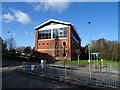
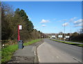
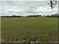
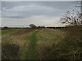
45 photos from this area
Area Information
Key information about the WF3 1BZ including its size, population, and administrative classification.
- Area Type
- Postcode
- Area Size
- 5946 m²
- Population
- 1380
- Population Density
- 3897 people/km²
House Prices in WF3 1BZ
12
Properties
£136,779
Average Sold Price
£54,000
Lowest Price
£236,000
Highest Price
Showing 12 properties
| Address | Type | Beds | Baths | Last Sale Price | Last Sale Date | |
|---|---|---|---|---|---|---|
| 8 Springwell Court, Tingley, Wakefield, WF3 1BZ | Semi-detached | 3 | 1 | £236,000 | May 2024 | |
| 5 Springwell Court, Tingley, Wakefield, WF3 1BZ | Semi-detached | 3 | - | £205,000 | Mar 2024 | |
| 14 Springwell Court, Tingley, Wakefield, WF3 1BZ | Semi-detached | 3 | 1 | £210,000 | Jun 2021 | |
| 9 Springwell Court, Tingley, Wakefield, WF3 1BZ | Semi-detached | 3 | - | £176,000 | Jul 2019 | |
| 1 Springwell Court, Tingley, Wakefield, WF3 1BZ | Detached | 3 | 2 | £175,000 | Dec 2017 | |
| 3 Springwell Court, Tingley, Wakefield, WF3 1BZ | Semi-detached | 3 | 2 | £138,500 | Nov 2014 | |
| 7 Springwell Court, Tingley, Wakefield, WF3 1BZ | Semi-detached | 3 | - | £143,000 | Sep 2014 | |
| 2 Springwell Court, Tingley, Wakefield, WF3 1BZ | house | - | - | £124,950 | May 2011 | |
| 4 Springwell Court, Tingley, Wakefield, WF3 1BZ | Terraced | - | - | £54,000 | Dec 1997 | |
| 11 Springwell Court, Tingley, Wakefield, WF3 1BZ | Semi-detached | - | - | £59,950 | Jan 1996 |
Page 1 of 2
Energy Efficiency in WF3 1BZ
Amenities
Schools
| Rank | School | Type | Entry gender | Ages |
|---|
Explore more schools in this area
Go to Schools tabDemographics
Household Size
Two person
most common
Accommodation Type
Houses
most common
Tenure
86
majority
Ethnic Group
White
most common
Religion
N/A
most common
Household Composition
N/A
most common
Age
47
median
Adults (30-64 years)
most common
Household Deprivation
N/A
with no deprivation
NS-SEC
35
in Lower managerial occupations
Explore more demographic insights in this area
Go to Demographics tabPlanning
Planning Constraints
- Flood RiskPremium
- Ramsar Wetland SitesPremium
- Area of Outstanding Natural BeautyPremium
- Protected Nature ReservePremium
- Protected WoodlandPremium