Area Overview for WF16 0LL
Photos of WF16 0LL
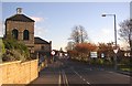
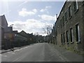
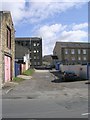

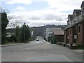
100 photos from this area
Area Information
Key information about the WF16 0LL including its size, population, and administrative classification.
- Area Type
- Postcode
- Area Size
- 2.9 hectares
- Population
- 1312
- Population Density
- 2923 people/km²
House Prices in WF16 0LL
33
Properties
£173,110
Average Sold Price
£49,995
Lowest Price
£260,000
Highest Price
Showing 33 properties
| Address | Type | Beds | Baths | Last Sale Price | Last Sale Date | |
|---|---|---|---|---|---|---|
| 37 Horton Street, Heckmondwike, WF16 0LL | house | 4 | 1 | £260,000 | Dec 2024 | |
| 21 Horton Street, Heckmondwike, WF16 0LL | Detached | 3 | 2 | £226,000 | Sep 2021 | |
| 35 Horton Street, Heckmondwike, WF16 0LL | Detached | 4 | - | £220,000 | Aug 2021 | |
| 30 Horton Street, Heckmondwike, WF16 0LL | house | - | - | £249,950 | Mar 2021 | |
| 5 Horton Street, Heckmondwike, WF16 0LL | Semi-detached | 3 | 2 | £221,000 | Feb 2021 | |
| 27 Horton Street, Heckmondwike, WF16 0LL | Detached | 3 | - | £195,000 | Oct 2020 | |
| 19 Horton Street, Heckmondwike, WF16 0LL | Detached | 4 | 2 | £252,500 | Dec 2019 | |
| The Old Curates House, Horton Street, Heckmondwike, WF16 0LL | Detached | 3 | 1 | £248,000 | Dec 2019 | |
| 36 Horton Street, Heckmondwike, WF16 0LL | Detached | 4 | 2 | £220,000 | Aug 2019 | |
| 22 Horton Street, Heckmondwike, WF16 0LL | Detached | 4 | 2 | £180,000 | Apr 2019 |
Page 1 of 4
Energy Efficiency in WF16 0LL
Amenities
Schools
| Rank | School | Type | Entry gender | Ages |
|---|
Explore more schools in this area
Go to Schools tabDemographics
Household Size
Two person
most common
Accommodation Type
Houses
most common
Tenure
81
majority
Ethnic Group
White
most common
Religion
N/A
most common
Household Composition
N/A
most common
Age
47
median
Adults (30-64 years)
most common
Household Deprivation
N/A
with no deprivation
NS-SEC
31
in Lower managerial occupations
Explore more demographic insights in this area
Go to Demographics tabPlanning
Planning Constraints
- Flood RiskPremium
- Ramsar Wetland SitesPremium
- Area of Outstanding Natural BeautyPremium
- Protected Nature ReservePremium
- Protected WoodlandPremium