Area Overview for WF15 7AN
Photos of WF15 7AN
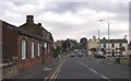
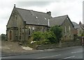
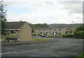
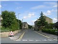
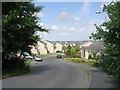
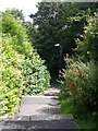
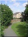
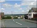
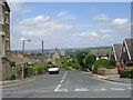
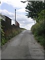
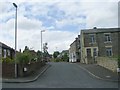
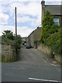
100 photos from this area
Area Information
Key information about the WF15 7AN including its size, population, and administrative classification.
- Area Type
- Postcode
- Area Size
- 3.6 hectares
- Population
- 1320
- Population Density
- 933 people/km²
House Prices in WF15 7AN
20
Properties
£176,045
Average Sold Price
£53,500
Lowest Price
£270,000
Highest Price
Showing 20 properties
| Address | Type | Beds | Baths | Last Sale Price | Last Sale Date | |
|---|---|---|---|---|---|---|
| 157 Norristhorpe Lane, Norristhorpe, Liversedge, WF15 7AN | Detached | 4 | - | £208,000 | Jan 2025 | |
| 238 Norristhorpe Lane, Norristhorpe, Liversedge, WF15 7AN | Terraced | 1 | 1 | £175,000 | Feb 2024 | |
| 179 Norristhorpe Lane, Norristhorpe, Liversedge, WF15 7AN | house | - | - | £245,000 | Jul 2021 | |
| 177 Norristhorpe Lane, Norristhorpe, Liversedge, WF15 7AN | Bungalow | 4 | 1 | £235,000 | Sep 2019 | |
| 244 Norristhorpe Lane, Norristhorpe, Liversedge, WF15 7AN | Detached | 3 | 1 | £270,000 | Nov 2017 | |
| 187-189 Norristhorpe Lane, Norristhorpe, Liversedge, WF15 7AN | Detached | 4 | 1 | £195,000 | Dec 2016 | |
| 199 Norristhorpe Lane, Norristhorpe, Liversedge, WF15 7AN | Semi-detached | - | - | £153,000 | Oct 2007 | |
| 240 Norristhorpe Lane, Norristhorpe, Liversedge, WF15 7AN | Cottage | 2 | 1 | £107,000 | Apr 2007 | |
| 173 Norristhorpe Lane, Norristhorpe, Liversedge, WF15 7AN | Terraced | - | - | £118,950 | Aug 2005 | |
| 201 Norristhorpe Lane, Norristhorpe, Liversedge, WF15 7AN | Semi-detached | - | - | £53,500 | May 1999 |
Page 1 of 2
Energy Efficiency in WF15 7AN
Amenities
Schools
| Rank | School | Type | Entry gender | Ages |
|---|
Explore more schools in this area
Go to Schools tabDemographics
Household Size
Family (3-5 people)
most common
Accommodation Type
Houses
most common
Tenure
87
majority
Ethnic Group
White
most common
Religion
N/A
most common
Household Composition
N/A
most common
Age
47
median
Adults (30-64 years)
most common
Household Deprivation
N/A
with no deprivation
NS-SEC
39
in Lower managerial occupations
Explore more demographic insights in this area
Go to Demographics tabPlanning
Planning Constraints
- Flood RiskPremium
- Ramsar Wetland SitesPremium
- Area of Outstanding Natural BeautyPremium
- Protected Nature ReservePremium
- Protected WoodlandPremium