Area Overview for WF15 7AL
Photos of WF15 7AL
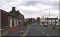
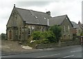
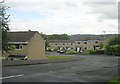
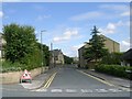
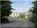
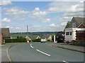
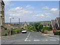
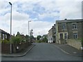
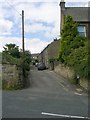
100 photos from this area
Area Information
Key information about the WF15 7AL including its size, population, and administrative classification.
- Area Type
- Postcode
- Area Size
- 2.4 hectares
- Population
- 1320
- Population Density
- 933 people/km²
House Prices in WF15 7AL
28
Properties
£168,000
Average Sold Price
£70,000
Lowest Price
£350,000
Highest Price
Showing 28 properties
| Address | Type | Beds | Baths | Last Sale Price | Last Sale Date | |
|---|---|---|---|---|---|---|
| 137 Norristhorpe Lane, Norristhorpe, Liversedge, WF15 7AL | Semi-detached | 3 | 1 | £317,500 | Mar 2025 | |
| 166 Norristhorpe Lane, Norristhorpe, Liversedge, WF15 7AL | Semi-detached | 3 | 1 | £180,000 | Mar 2023 | |
| 151 Norristhorpe Lane, Norristhorpe, Liversedge, WF15 7AL | house | - | - | £150,000 | May 2022 | |
| 194 Norristhorpe Lane, Norristhorpe, Liversedge, WF15 7AL | house | - | - | £350,000 | Dec 2021 | |
| 139 Norristhorpe Lane, Norristhorpe, Liversedge, WF15 7AL | house | - | - | £174,000 | Dec 2021 | |
| 188 Norristhorpe Lane, Norristhorpe, Liversedge, WF15 7AL | Semi-detached | 4 | - | £190,000 | Jul 2021 | |
| 178 Norristhorpe Lane, Norristhorpe, Liversedge, WF15 7AL | house | - | - | £150,000 | Nov 2020 | |
| 190 Norristhorpe Lane, Norristhorpe, Liversedge, WF15 7AL | house | - | - | £100,000 | Mar 2016 | |
| 200 Norristhorpe Lane, Norristhorpe, Liversedge, WF15 7AL | Detached | 4 | 2 | £140,000 | Jan 2015 | |
| 147 Norristhorpe Lane, Norristhorpe, Liversedge, WF15 7AL | house | - | - | £106,000 | Nov 2012 |
Page 1 of 3
Energy Efficiency in WF15 7AL
Amenities
Schools
| Rank | School | Type | Entry gender | Ages |
|---|
Explore more schools in this area
Go to Schools tabDemographics
Household Size
Family (3-5 people)
most common
Accommodation Type
Houses
most common
Tenure
87
majority
Ethnic Group
White
most common
Religion
N/A
most common
Household Composition
N/A
most common
Age
47
median
Adults (30-64 years)
most common
Household Deprivation
N/A
with no deprivation
NS-SEC
39
in Lower managerial occupations
Explore more demographic insights in this area
Go to Demographics tabPlanning
Planning Constraints
- Flood RiskPremium
- Ramsar Wetland SitesPremium
- Area of Outstanding Natural BeautyPremium
- Protected Nature ReservePremium
- Protected WoodlandPremium