Area Overview for WF1 3JW
Photos of WF1 3JW
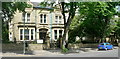
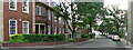
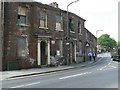


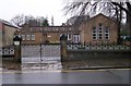
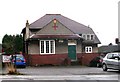
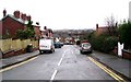
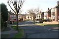

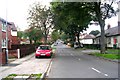
100 photos from this area
Area Information
Key information about the WF1 3JW including its size, population, and administrative classification.
- Area Type
- Postcode
- Area Size
- 9404 m²
- Population
- 1654
- Population Density
- 3090 people/km²
House Prices in WF1 3JW
18
Properties
£198,895
Average Sold Price
£75,000
Lowest Price
£454,000
Highest Price
Showing 18 properties
| Address | Type | Beds | Baths | Last Sale Price | Last Sale Date | |
|---|---|---|---|---|---|---|
| 59 Leeds Road, Wakefield, WF1 3JW | Detached | 3 | 1 | £213,000 | Aug 2025 | |
| 35 Leeds Road, Wakefield, WF1 3JW | Terraced | 4 | 2 | £290,000 | May 2025 | |
| 57 Leeds Road, Wakefield, WF1 3JW | Terraced | 4 | 1 | £260,000 | Sep 2023 | |
| 17 Leeds Road, Wakefield, WF1 3JW | house | - | - | £205,000 | Mar 2022 | |
| 5 Leeds Road, Wakefield, WF1 3JW | Detached | 4 | - | £454,000 | Aug 2015 | |
| 19 Leeds Road, Wakefield, WF1 3JW | house | 3 | - | £175,099 | Sep 2014 | |
| 61 Leeds Road, Wakefield, WF1 3JW | Terraced | 4 | - | £120,000 | Nov 2006 | |
| 45 Leeds Road, Wakefield, WF1 3JW | Terraced | - | - | £187,500 | Jun 2004 | |
| 33 Leeds Road, Wakefield, WF1 3JW | Terraced | - | - | £116,250 | Jun 2002 | |
| 31 Leeds Road, Wakefield, WF1 3JW | Terraced | - | - | £75,000 | Oct 2001 |
Page 1 of 2
Energy Efficiency in WF1 3JW
Amenities
Schools
| Rank | School | Type | Entry gender | Ages |
|---|
Explore more schools in this area
Go to Schools tabDemographics
Household Size
Two person
most common
Accommodation Type
Houses
most common
Tenure
66
majority
Ethnic Group
White
most common
Religion
N/A
most common
Household Composition
N/A
most common
Age
47
median
Adults (30-64 years)
most common
Household Deprivation
N/A
with no deprivation
NS-SEC
49
in Lower managerial occupations
Explore more demographic insights in this area
Go to Demographics tabPlanning
Planning Constraints
- Flood RiskPremium
- Ramsar Wetland SitesPremium
- Area of Outstanding Natural BeautyPremium
- Protected Nature ReservePremium
- Protected WoodlandPremium