Area Overview for WF1 3JL
Photos of WF1 3JL
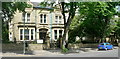
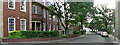
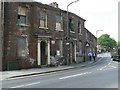

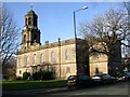
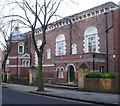
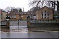
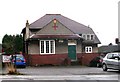
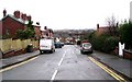
100 photos from this area
Area Information
Key information about the WF1 3JL including its size, population, and administrative classification.
- Area Type
- Postcode
- Area Size
- 9856 m²
- Population
- 1654
- Population Density
- 3090 people/km²
House Prices in WF1 3JL
14
Properties
£157,136
Average Sold Price
£86,000
Lowest Price
£230,000
Highest Price
Showing 14 properties
| Address | Type | Beds | Baths | Last Sale Price | Last Sale Date | |
|---|---|---|---|---|---|---|
| 40 Leeds Road, Wakefield, WF1 3JL | house | - | - | £230,000 | Dec 2022 | |
| 18 Leeds Road, Wakefield, WF1 3JL | Retail | 2 | 1 | £200,000 | Aug 2022 | |
| 16 Leeds Road, Wakefield, WF1 3JL | Detached | 2 | 1 | £134,000 | Dec 2017 | |
| 32 Leeds Road, Wakefield, WF1 3JL | house | 5 | - | £192,000 | Mar 2014 | |
| 42 Leeds Road, Wakefield, WF1 3JL | house | - | - | £170,000 | Jun 2004 | |
| 36 Leeds Road, Wakefield, WF1 3JL | Terraced | 1 | 1 | £86,000 | Oct 1999 | |
| 34 Leeds Road, Wakefield, WF1 3JL | Terraced | 5 | - | £87,950 | Oct 1997 | |
| 38 Leeds Road, Wakefield, WF1 3JL | Terraced | 3 | 2 | - | - | |
| 30 Leeds Road, Wakefield, WF1 3JL | Semi-detached | - | - | - | - | |
| 24 Leeds Road, Wakefield, WF1 3JL | house | - | - | - | - |
Page 1 of 2
Energy Efficiency in WF1 3JL
Amenities
Schools
| Rank | School | Type | Entry gender | Ages |
|---|
Explore more schools in this area
Go to Schools tabDemographics
Household Size
Two person
most common
Accommodation Type
Houses
most common
Tenure
66
majority
Ethnic Group
White
most common
Religion
N/A
most common
Household Composition
N/A
most common
Age
47
median
Adults (30-64 years)
most common
Household Deprivation
N/A
with no deprivation
NS-SEC
49
in Lower managerial occupations
Explore more demographic insights in this area
Go to Demographics tabPlanning
Planning Constraints
- Flood RiskPremium
- Ramsar Wetland SitesPremium
- Area of Outstanding Natural BeautyPremium
- Protected Nature ReservePremium
- Protected WoodlandPremium