Area Overview for WF1 2ER
Photos of WF1 2ER


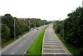
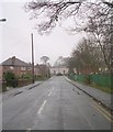
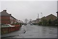
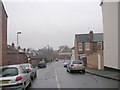
100 photos from this area
Area Information
Key information about the WF1 2ER including its size, population, and administrative classification.
- Area Type
- Postcode
- Area Size
- 9970 m²
- Population
- 1557
- Population Density
- 4361 people/km²
House Prices in WF1 2ER
24
Properties
£227,737
Average Sold Price
£56,000
Lowest Price
£312,000
Highest Price
Showing 24 properties
| Address | Type | Beds | Baths | Last Sale Price | Last Sale Date | |
|---|---|---|---|---|---|---|
| 10 Duke Way, Wakefield, WF1 2ER | Flat | 2 | 1 | £230,000 | Aug 2023 | |
| 8 Duke Way, Wakefield, WF1 2ER | Semi-detached | 3 | 2 | £235,000 | Feb 2022 | |
| 18 Duke Way, Wakefield, WF1 2ER | Semi-detached | 3 | 1 | £160,000 | Aug 2020 | |
| 28 Duke Way, Wakefield, WF1 2ER | Detached | 4 | 1 | £248,000 | Feb 2019 | |
| 20 Duke Way, Wakefield, WF1 2ER | house | - | - | £120,000 | Oct 2018 | |
| 3 Duke Way, Wakefield, WF1 2ER | Detached | 4 | 1 | £312,000 | Dec 2017 | |
| 9 Duke Way, Wakefield, WF1 2ER | house | - | - | £56,000 | Sep 2017 | |
| 4 Duke Way, Wakefield, WF1 2ER | Detached | 4 | 2 | £257,500 | Jul 2017 | |
| 1 Duke Way, Wakefield, WF1 2ER | house | - | - | £299,995 | Dec 2012 | |
| 5 Duke Way, Wakefield, WF1 2ER | house | - | - | £239,995 | Nov 2012 |
Page 1 of 3
Energy Efficiency in WF1 2ER
Amenities
Schools
| Rank | School | Type | Entry gender | Ages |
|---|
Explore more schools in this area
Go to Schools tabDemographics
Household Size
One person
most common
Accommodation Type
Houses
most common
Tenure
46
majority
Ethnic Group
White
most common
Religion
N/A
most common
Household Composition
N/A
most common
Age
47
median
Adults (30-64 years)
most common
Household Deprivation
N/A
with no deprivation
NS-SEC
21
in Lower managerial occupations
Explore more demographic insights in this area
Go to Demographics tabPlanning
Planning Constraints
- Flood RiskPremium
- Ramsar Wetland SitesPremium
- Area of Outstanding Natural BeautyPremium
- Protected Nature ReservePremium
- Protected WoodlandPremium