Area Overview for TS15 0HJ
Photos of TS15 0HJ
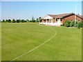
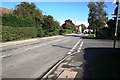
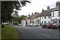
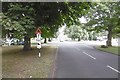
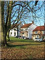
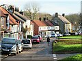
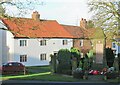
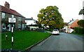
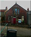
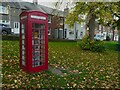
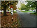
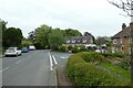
22 photos from this area
Area Information
Key information about the TS15 0HJ including its size, population, and administrative classification.
- Area Type
- Postcode
- Area Size
- 1.3 hectares
- Population
- 2366
- Population Density
- 78 people/km²
House Prices in TS15 0HJ
14
Properties
£357,857
Average Sold Price
£245,000
Lowest Price
£550,000
Highest Price
Showing 14 properties
| Address | Type | Beds | Baths | Last Sale Price | Last Sale Date | |
|---|---|---|---|---|---|---|
| The Maples, 3 Willins Close, Hutton Rudby, TS15 0HJ | house | - | - | £550,000 | Sep 2023 | |
| 6 Willins Close, Hutton Rudby, TS15 0HJ | house | - | - | £425,000 | Feb 2023 | |
| 12 Willins Close, Hutton Rudby, TS15 0HJ | Bungalow | - | - | £360,000 | Jun 2022 | |
| 9 Willins Close, Hutton Rudby, TS15 0HJ | Bungalow | - | - | £317,500 | Dec 2017 | |
| Lindisfarne, 16 Willins Close, Hutton Rudby, TS15 0HJ | Bungalow | 3 | 2 | £287,500 | Mar 2013 | |
| 10 Willins Close, Hutton Rudby, TS15 0HJ | Bungalow | 3 | - | £320,000 | Sep 2010 | |
| 15 Willins Close, Hutton Rudby, TS15 0HJ | Bungalow | - | - | £245,000 | Jan 2005 | |
| 8 Willins Close, Hutton Rudby, TS15 0HJ | Bungalow | 3 | 1 | - | - | |
| 7 Willins Close, Hutton Rudby, TS15 0HJ | Detached | - | - | - | - | |
| 11 Willins Close, Hutton Rudby, TS15 0HJ | Bungalow | - | - | - | - |
Page 1 of 2
Energy Efficiency in TS15 0HJ
Amenities
Schools
| Rank | School | Type | Entry gender | Ages |
|---|
Explore more schools in this area
Go to Schools tabDemographics
Household Size
Two person
most common
Accommodation Type
Houses
most common
Tenure
82
majority
Ethnic Group
White
most common
Religion
N/A
most common
Household Composition
N/A
most common
Age
47
median
Adults (30-64 years)
most common
Household Deprivation
N/A
with no deprivation
NS-SEC
49
in Lower managerial occupations
Explore more demographic insights in this area
Go to Demographics tabPlanning
Planning Constraints
- Flood RiskPremium
- Ramsar Wetland SitesPremium
- Area of Outstanding Natural BeautyPremium
- Protected Nature ReservePremium
- Protected WoodlandPremium