Area Overview for TS15 0DN
Photos of TS15 0DN
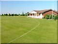
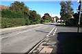
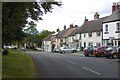
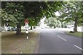
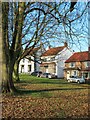
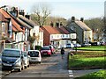
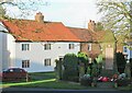
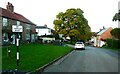
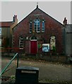
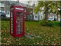
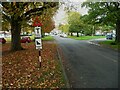
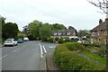
22 photos from this area
Area Information
Key information about the TS15 0DN including its size, population, and administrative classification.
- Area Type
- Postcode
- Area Size
- 40.1 hectares
- Population
- 2366
- Population Density
- 78 people/km²
House Prices in TS15 0DN
15
Properties
£330,250
Average Sold Price
£95,000
Lowest Price
£675,000
Highest Price
Showing 15 properties
| Address | Type | Beds | Baths | Last Sale Price | Last Sale Date | |
|---|---|---|---|---|---|---|
| Broadmeadows, 3 Garbutts Lane, Hutton Rudby, TS15 0DN | house | - | - | £675,000 | Mar 2022 | |
| The Firs, 19 Garbutts Lane, Hutton Rudby, TS15 0DN | Detached | 4 | 1 | £500,000 | Nov 2020 | |
| Dormouse Cottage, 9A Garbutts Lane, Hutton Rudby, TS15 0DN | Bungalow | 3 | 1 | £312,500 | Mar 2018 | |
| Knoydart, 13 Garbutts Lane, Hutton Rudby, TS15 0DN | Bungalow | - | - | £400,000 | Feb 2018 | |
| Swiss Cottage, 17 Garbutts Lane, Hutton Rudby, TS15 0DN | Bungalow | 3 | - | £275,000 | Jul 2013 | |
| Huttons End, 21 Garbutts Lane, Hutton Rudby, TS15 0DN | Detached | - | - | £270,000 | May 2008 | |
| Braemar, 5 Garbutts Lane, Hutton Rudby, TS15 0DN | Detached | 5 | 4 | £407,500 | May 2004 | |
| Hundlebrook, 11 Garbutts Lane, Hutton Rudby, TS15 0DN | Bungalow | - | - | £137,500 | Jun 2001 | |
| Hutton Fields, Garbutts Lane, Hutton Rudby, TS15 0DN | Detached | - | - | £230,000 | Aug 1998 | |
| Elwick Grove, 7 Garbutts Lane, Hutton Rudby, TS15 0DN | Detached | - | - | £95,000 | Oct 1995 |
Page 1 of 2
Energy Efficiency in TS15 0DN
Amenities
Schools
| Rank | School | Type | Entry gender | Ages |
|---|
Explore more schools in this area
Go to Schools tabDemographics
Household Size
Two person
most common
Accommodation Type
Houses
most common
Tenure
82
majority
Ethnic Group
White
most common
Religion
N/A
most common
Household Composition
N/A
most common
Age
47
median
Adults (30-64 years)
most common
Household Deprivation
N/A
with no deprivation
NS-SEC
49
in Lower managerial occupations
Explore more demographic insights in this area
Go to Demographics tabPlanning
Planning Constraints
- Flood RiskPremium
- Ramsar Wetland SitesPremium
- Area of Outstanding Natural BeautyPremium
- Protected Nature ReservePremium
- Protected WoodlandPremium