Area Overview for Whiston
Photos of Whiston


Area Information
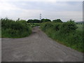
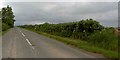
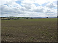
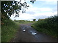
Living in Whiston offers a distinctly quiet life within the Liverpool City Region. This civil parish covers an area of 10.3 km² and hosts a population of 1240 residents. With a population density of 121 people per square kilometre, you will find a low-density environment characterised by open space and minimal urban congestion. The settlement functions primarily as a residential community for those working in nearby towns or on commuter routes across Merseyside. Daily life here revolves around local amenities and natural surroundings, given the area's size relative to its small resident base. There is no rush to interact with strangers or navigate crowded streets. The layout suggests a neighbourhood where residents know their neighbours well, supported by the low number of households per square mile. You should expect a pace of life that prioritises tranquility over the hustle of major urban centres. This setting appeals to individuals seeking a foothold in the region without sacrificing peace. The geography allows for easy access to green spaces while maintaining a strong sense of locality. Prospective buyers here find a residence defined by its separation from high-volume traffic and dense development. Whiston remains a self-contained parish where the primary draw is the ability to settle down in a spacious, low-pressure environment.
- Area Type
- Parish
- Area Size
- 10.3 km²
- Population
- 1240
- Population Density
- 121 people/km²
Demographics
The community in Whiston displays a clear demographic profile shaped by the age and tenure of its residents. The median age sits at 70 years, marking this as a mature neighbourhood rather than one dominated by young families or students. This age distribution explains the household composition and accommodation patterns found throughout the parish. Home ownership stands at 78%, a significantly high figure compared to national averages. This statistic indicates that rent is uncommon here, with most households owning their property outright or through a mortgage. The dominance of home ownership correlates directly with the older population median, where residents have likely paid off loans over decades. Accommodation types reflect this stability, consisting largely of established homes rather than purpose-built rentals. While the data does not specify ethnicity or religious breakdown, the household composition suggests a settled, long-term community. You will find fewer transient populations compared to neighbouring urban zones. This demographic structure creates a stable social fabric where neighbours have resided for many years. Buyers should anticipate a community where families and retirees maintain strong local ties. The high ownership rate implies that property prices reflect settled value rather than speculative trends. Whiston caters to those who prefer a quiet retirement or a family home in a mature district.
Household Size
Accommodation Type
Tenure
Ethnic Group
Religion
Household Composition
Age
Household Deprivation
NS-SEC
Explore more demographic insights in this area
Go to Demographics tabPlanning
Planning Constraints
- Flood RiskPremium
- Ramsar Wetland SitesPremium
- Area of Outstanding Natural BeautyPremium
- Protected Nature ReservePremium
- Protected WoodlandPremium