Area Overview for South Yorkshire
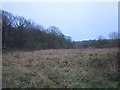
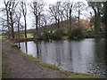
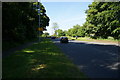
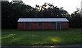
Photos of South Yorkshire


Area Information
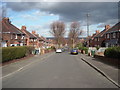
South Yorkshire stands as a distinct ceremonial county in England, covering a vast landmass of 1553.2 square kilometres. You are entering a region defined by its scale and varied history rather than a single homogeneous character. Living in South Yorkshire means navigating an area where urban centres blend with expansive surroundings across a substantial territory. The sheer size of the county allows for significant distance between towns, which shapes the daily rhythm of life for residents. You will find that the area accommodates a wide range of lifestyle preferences within its borders, though the scale can influence how far you travel for work or leisure. Understanding the geography is essential for anyone considering homes in South Yorkshire, as the physical span dictates travel times and access to amenities differently than in smaller, more compact locations. This region offers a concrete reality for buyers who appreciate a sense of space without leaving the state entirely. The area's identity is firmly rooted in its geography, making it a practical choice for those who value land area alongside traditional housing markets.
- Area Type
- Ceremonial Counties Region
- Area Size
- 1553.2 km²
- Population
- Not available
- Population Density
- Not available
Demographics
The community profile of South Yorkshire reveals a population with a notably high median age of 70. This figure indicates that a significant portion of the resident demographic comprises older adults who likely enjoy a settled and established lifestyle. You can expect the area to cater well to those seeking retirement communities or homes near loved ones, as the age structure does not skew heavily towards young families. Home ownership stands at a solid 62 per cent, suggesting that a majority of residents have purchased their properties rather than renting. This high rate of ownership often correlates with stability, increased investment in dwellings, and long-term settlement within the neighbourhood. The data points to a community where people have roots, contributing to a quieter, more predictable environment compared to areas with younger populations. While specific details on household composition, accommodation types, and ethnic diversity are not quantified in the current records, the clear picture of age and ownership emerges as the dominant demographic fact for this region. For you, this means a mature setting where life moves at a measured pace, anchored by a stable property market.