Area Overview for S71 4AU
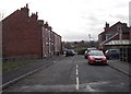
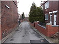
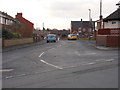
Photos of S71 4AU


Area Information
Living in S71 4AU offers a distinct experience within the wider S71 postcode area. This specific cluster covers just 3,973 square metres yet supports a population of 1,655 residents, resulting in a density of 695 people per square kilometre. The compact nature of this residential zone creates a defined neighbourhood atmosphere where daily life often revolves around local amenities and shared spaces. You are entering a community that prioritises density within a manageable footprint. This setting appeals to those seeking a contained living environment rather than sprawling suburbs. The area functions as a cohesive unit where proximity to services is a defining feature of resident life. Prospective homebuyers will find this postcode represents a specific slice of housing market activity distinct from the broader S71 region. The communal feel is reinforced by the concentration of households in a relatively small geographic boundary. Daily routines focus on local resources, from the corner shops within easy reach to the transport links that connect you to wider opportunities. You should expect a setting that balances residential quiet with practical accessibility to essential services.
- Area Type
- Postcode
- Area Size
- 3973 m²
- Population
- 1655
- Population Density
- 695 people/km²
The property market in S71 4AU is characterised by a dominant presence of freehold housing. With accommodation types defined strictly as houses, the entire residential stock comprises detached, semi-detached, or terraced properties rather than flats or maisonettes. Home ownership levels provide critical context for the market; 69% of residents are outright owners. This high proportion signals a region where property values have likely matured and turnover has stabilised. You will find fewer landlords competing for tenants compared to areas with lower ownership rates. This trend suggests a market where buying is often a retirement planning strategy or a long-term investment for current residents. Prospective buyers should view this postcode as an established residential zone where the majority of transactions involve owner-to-owner transfers or family inheritances. The absence of flats simplifies your search criteria significantly, as you do not need to consider leasehold nuances or common maintenance funds. The housing stock uniformly consists of houses, which aligns with the demographic evidence showing a median age of 47 and a population dominated by adults aged 30 to 64.
House Prices in S71 4AU
Showing 12 properties
| Address | Type | Beds | Baths | Last Sale Price | Last Sale Date | |
|---|---|---|---|---|---|---|
| 4 Caldervale, Royston, Barnsley, S71 4AU | Flat | - | - | - | - | |
| 3 Caldervale, Royston, Barnsley, S71 4AU | Flat | - | - | - | - | |
| 8 Caldervale, Royston, Barnsley, S71 4AU | Flat | - | - | - | - | |
| 7 Caldervale, Royston, Barnsley, S71 4AU | Flat | - | - | - | - | |
| 1 Caldervale, Royston, Barnsley, S71 4AU | Flat | - | - | - | - | |
| 6 Caldervale, Royston, Barnsley, S71 4AU | Flat | - | - | - | - | |
| 9 Caldervale, Royston, Barnsley, S71 4AU | Flat | - | - | - | - | |
| 12 Caldervale, Royston, Barnsley, S71 4AU | Flat | - | - | - | - | |
| 2 Caldervale, Royston, Barnsley, S71 4AU | Flat | - | - | - | - | |
| 11 Caldervale, Royston, Barnsley, S71 4AU | Flat | - | - | - | - |
Energy Efficiency in S71 4AU
Residents of S71 4AU benefit from immediate access to essential retail and transport hubs. Within practical reach, you find five retail outlets including Asda Royston, Spar Royston, and Co-op Royston. These venues provide comprehensive options for groceries, daily necessities, and household supplies. Just half a mile away, rail connections are supported by five stations, including Barnsley Railway Station, Fitzwilliam Railway Station, and Darton Railway Station. These points of entry facilitate efficient travel to wider employment centres and commercial districts. The proximity of Asda Royston and Spar Royston ensures you can manage weekly shopping without lengthy journeys. Access to Barnsley and Fitzwilliam stations particularly enhances your mobility, linking S71 4AU to major urban networks. You will find that daily errands require minimal planning due to the density of these services. The combination of local supermarkets and nearby train stations creates a lifestyle defined by convenience. This amenity mix supports the high home ownership rate by making estate living practical and sustainable for families.
Amenities
Schools
Families considering S71 4AU have access to two primary schools within the vicinity. The first option is Royston St John the Baptist Church of England Voluntary Aided Primary School. This institution serves the local younger population as a voluntary aided establishment. The second option is Royston St John Baptist CE Primary, which holds a notable Ofsted rating of good. This rating confirms the school meets required standards for education quality and student care. Both schools denote a Christian ethos in their naming convention, which may influence parental choices regarding religious education. Neither school appears in the middle or secondary category, indicating that your local catchment area focuses on early years and primary education. You will likely need to look beyond S71 4AU for secondary schooling options for older children. The presence of two primary institutions with established reputations supports families with children aged four to eleven. These schools serve the immediate residential cluster, providing a locally rooted educational environment for the children of the 69% owner-occupied demographic.
| Rank | School | Type | Entry gender | Ages |
|---|
Explore more schools in this area
Go to Schools tabDemographics
The community in S71 4AU reflects a settled population with a median age of 47 years. Adults between 30 and 64 years represent the most common age range, confirming the area caters to established families and professionals nearing retirement. Stability is evident in the high home ownership rate, which stands at 69%. Nearly seven out of every ten residents own their accommodation outright, indicating strong long-term roots in S71 4AU. Houses constitute the predominant accommodation type, suggesting a landscape defined by traditional family homes rather than flats or purpose-built apartments. Demographic analysis also shows that the predominant ethnic group identifies as White, reflecting the established character of the neighbourhood. You are looking at an area with clear demographic cohesion where residents share similar life stages and housing preferences. This profile matters when you consider the pace of life, the types of neighbours you might meet, and the stability of the local schools and community spaces. The age distribution supports a спокойная living environment without the volatility typical of transient rental estates or student quarters.
Household Size
Accommodation Type
Tenure
Ethnic Group
Religion
Household Composition
Age
Household Deprivation
NS-SEC
Explore more demographic insights in this area
Go to Demographics tabPlanning
Planning Constraints
- Flood RiskPremium
- Ramsar Wetland SitesPremium
- Area of Outstanding Natural BeautyPremium
- Protected Nature ReservePremium
- Protected WoodlandPremium