Area Overview for S71 4AT
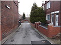
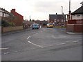
Photos of S71 4AT


Area Information
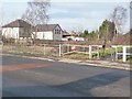
S71 4AT represents a compact residential cluster in England, defined by its specific postcode boundary and very limited physical footprint. This area covers just 1.4 hectares, making it one of the smallest residential zones in the national landscape. You will find 1,655 residents living within this tight space, resulting in a population density of 695 people per square kilometre. Despite its small size, the area hosts a substantial community where daily life centres around close neighbourhood ties. The high density means streets are populated, yet the character remains distinctly suburban rather than urban. Living in S71 4AT offers the advantage of a recognised postcode that simplifies local searches and administrative processes. The area functions as a self-contained residential hub where the proximity of neighbours is immediate. Your move here places you within a defined cluster that separates clearly from the wider surrounding towns. This specific location, identified as S71 4AT, provides a solid foundation for establishing roots without the sprawling distances found in larger conurbations.
- Area Type
- Postcode
- Area Size
- 1.4 hectares
- Population
- 1655
- Population Density
- 695 people/km²
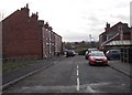
The housing market in S71 4AT is defined by a clear dominance of owner-occupiers, with 69% of residents holding titles to their properties. This statistic indicates a robust household where long-term living takes precedence over short-term renting. The vast majority of homes in this postcode are houses, forming the core of the local housing stock. You will rarely find purpose-built flats or high-rise blocks here, as the accommodation type is exclusively house-based. This configuration suits families who require garden space and rooms for children, which aligns with the area's median age of 47. Buyers looking at S71 4AT should expect a market where purchase prices reflect the permanence of the tenure. The high ownership percentage often leads to stable property values and less churn in the neighbourhood. When viewing properties, you will find that many have historically been passed down through generations or carefully maintained by older owners. This consistency creates a reliable market environment where sellers are often motivated by life changes rather than investment flipping. The entire local amenity and transport strategy caters specifically to this owner-occupied demographic.
House Prices in S71 4AT
Showing 35 properties
| Address | Type | Beds | Baths | Last Sale Price | Last Sale Date | |
|---|---|---|---|---|---|---|
| 22 Cross Lane, Royston, Barnsley, S71 4AT | Semi-detached | 3 | 1 | £170,000 | Mar 2025 | |
| 38 Cross Lane, Royston, Barnsley, S71 4AT | Semi-detached | 3 | 1 | £91,000 | Mar 2025 | |
| 28 Cross Lane, Royston, Barnsley, S71 4AT | Semi-detached | 3 | 1 | £150,000 | Sep 2024 | |
| 26 Cross Lane, Royston, Barnsley, S71 4AT | Semi-detached | 3 | 1 | £95,250 | May 2020 | |
| 12A Cross Lane, Royston, Barnsley, S71 4AT | house | - | - | £87,500 | Mar 2019 | |
| 14 Cross Lane, Royston, Barnsley, S71 4AT | Semi-detached | 3 | - | £875,000 | Sep 2017 | |
| 10 Cross Lane, Royston, Barnsley, S71 4AT | Terraced | 3 | - | £72,500 | Nov 2013 | |
| 11 Cross Lane, Royston, Barnsley, S71 4AT | Flat | - | - | £53,350 | Mar 2011 | |
| 12 Cross Lane, Royston, Barnsley, S71 4AT | house | - | - | £113,850 | Jul 2006 | |
| 35 Cross Lane, Royston, Barnsley, S71 4AT | house | - | - | £50,000 | Mar 2003 |
Energy Efficiency in S71 4AT
Life in S71 4AT revolves around a well-stocked range of retail and transport amenities within practical reach. For shopping needs, you can easily visit Asda Royston, Spar Royston, and Co-op Royston, all part of the five retail options immediately available. These supermarkets provide everything from fresh produce to household essentials, eliminating the need for long car journeys just to reload the pantry. Access to rail transport is equally accessible, with five stations nearby including Barnsley Railway Station, Fitzwilliam Railway Station, and Darton Railway Station. The number of retail outlets and transport hubs suggests a location that benefits from the wider town's services despite its small 1.4-hectare footprint. You will find that daily necessities are a short drive or bike ride away at most. The concentration of Asda, Spar, and Co-op ensures that food shopping is convenient regardless of your shopping time. This blend of hyper-local retail and wider regional rail links makes S71 4AT a practical base for families who value independence.
Amenities
Schools
Families living in S71 4AT have convenient access to two primary schools that serve the local educational needs. Royston St John the Baptist Church of England Voluntary Aided Primary School stands as a local option for younger children. Just a short distance away, Royston St John Baptist CE Primary operates with a 'good' Ofsted rating, providing a verified standard of education for your children. You will not find secondary schools listed in the immediate proximity of this specific postcode, meaning pupils must travel to the wider Royston area for older education stages. The presence of Catholic denominational schools, indicated by the 'CE' and 'Church of England' designations, offers denominational schooling alongside the Church Voluntary Aided option. For prospective parents buying homes in S71 4AT, these two institutions provide a solid spindrier for early education without requiring a commute. The 'good' rating attached to Royston St John Baptist CE Primary serves as a concrete quality marker for the estate. School catchment areas for these primary institutions are the first consideration when assessing a property purchase in this cluster.
| Rank | School | Type | Entry gender | Ages |
|---|
Explore more schools in this area
Go to Schools tabDemographics
The community within S71 4AT is mature and stable, reflected in a median age of 47 years. Residents primarily fall into the adult age range between 30 and 64 years, keeping the neighbourhood away from the volatility often found in student-heavy zones. A strong attachment to local property is evident, with 69% of households owning their homes outright or with a mortgage. This high ownership rate signals a settled population that has invested in the area over time. Most residents live in houses rather than flats or converted apartments, creating a streetscape dominated by detached or semi-detached properties. The demographic profile is predominantly White, aligning with the broader historical settlement patterns of the region. As you explore homes in S71 4AT, you will encounter a population that values stability and traditional family living environments. The lack of significant youth or elderly skew suggests a balanced community where working families and older adults coexist comfortably. This age structure often correlates with lower energy requirements for local services compared to areas with many young children or transient workers.
Household Size
Accommodation Type
Tenure
Ethnic Group
Religion
Household Composition
Age
Household Deprivation
NS-SEC
Explore more demographic insights in this area
Go to Demographics tabPlanning
Planning Constraints
- Flood RiskPremium
- Ramsar Wetland SitesPremium
- Area of Outstanding Natural BeautyPremium
- Protected Nature ReservePremium
- Protected WoodlandPremium