Area Overview for S70 5PG
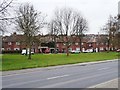
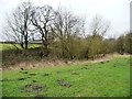
Photos of S70 5PG
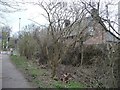
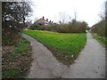
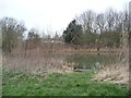
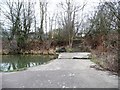
![The former Worsbrough branch canal [lower level] in S70 5PG](https://images.propbar.co.uk/images/geograph/48/73/4873863_120.jpg)
44 photos from this area
Area Information
Key information about the S70 5PG including its size, population, and administrative classification.
- Area Type
- Postcode
- Area Size
- 7.2 hectares
- Population
- 1467
- Population Density
- 706 people/km²
House Prices in S70 5PG
20
Properties
£51,750
Average Sold Price
£13,500
Lowest Price
£90,000
Highest Price
Showing 20 properties
| Address | Type | Beds | Baths | Last Sale Price | Last Sale Date | |
|---|---|---|---|---|---|---|
| 10 West Street, Worsbrough Bridge, Barnsley, S70 5PG | Semi-detached | 3 | 1 | £90,000 | Jun 2022 | |
| 14A West Street, Worsbrough Bridge, Barnsley, S70 5PG | Semi-detached | - | - | £13,500 | Dec 2001 | |
| The Bungalow, The Dale Tavern, West Street, Worsbrough Bridge, Barnsley, S70 5PG | restaurant_cafe | - | - | - | - | |
| Thunder Moon Tattoos, West Street, Worsbrough Bridge, Barnsley, S70 5PG | shop | - | - | - | - | |
| 26 West Street, Worsbrough Bridge, Barnsley, S70 5PG | Flat | - | - | - | - | |
| Unit 1, West Street, Worsbrough Bridge, Barnsley, S70 5PG | office_workshop | - | - | - | - | |
| 18 West Street, Worsbrough Bridge, Barnsley, S70 5PG | Flat | - | - | - | - | |
| 16A West Street, Worsbrough Bridge, Barnsley, S70 5PG | Flat | - | - | - | - | |
| 20A West Street, Worsbrough Bridge, Barnsley, S70 5PG | Semi-detached | - | - | - | - | |
| 20 West Street, Worsbrough Bridge, Barnsley, S70 5PG | Flat | - | - | - | - |
Page 1 of 2
Energy Efficiency in S70 5PG
Amenities
Schools
| Rank | School | Type | Entry gender | Ages |
|---|
Explore more schools in this area
Go to Schools tabDemographics
Household Size
Two person
most common
Accommodation Type
Houses
most common
Tenure
66
majority
Ethnic Group
White
most common
Religion
N/A
most common
Household Composition
N/A
most common
Age
47
median
Adults (30-64 years)
most common
Household Deprivation
N/A
with no deprivation
NS-SEC
21
in Lower managerial occupations
Explore more demographic insights in this area
Go to Demographics tabPlanning
Planning Constraints
- Flood RiskPremium
- Ramsar Wetland SitesPremium
- Area of Outstanding Natural BeautyPremium
- Protected Nature ReservePremium
- Protected WoodlandPremium