Area Overview for S70 5NR
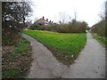
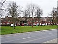
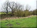
Photos of S70 5NR
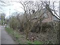
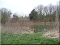
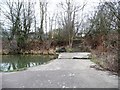
![The former Worsbrough branch canal [lower level] in S70 5NR](https://images.propbar.co.uk/images/geograph/48/73/4873863_120.jpg)
44 photos from this area
Area Information
Key information about the S70 5NR including its size, population, and administrative classification.
- Area Type
- Postcode
- Area Size
- 8821 m²
- Population
- 1467
- Population Density
- 706 people/km²
House Prices in S70 5NR
25
Properties
£79,667
Average Sold Price
£35,000
Lowest Price
£116,000
Highest Price
Showing 25 properties
| Address | Type | Beds | Baths | Last Sale Price | Last Sale Date | |
|---|---|---|---|---|---|---|
| 97 Oakdale, Worsbrough Bridge, Barnsley, S70 5NR | house | - | - | £110,000 | Jan 2025 | |
| 105 Oakdale, Worsbrough Bridge, Barnsley, S70 5NR | house | - | - | £90,000 | Sep 2020 | |
| 93 Oakdale, Worsbrough Bridge, Barnsley, S70 5NR | Semi-detached | 3 | 1 | £95,000 | Feb 2019 | |
| 109 Oakdale, Worsbrough Bridge, Barnsley, S70 5NR | house | - | - | £73,000 | Dec 2010 | |
| 111 Oakdale, Worsbrough Bridge, Barnsley, S70 5NR | Semi-detached | - | - | £116,000 | Oct 2007 | |
| 99 Oakdale, Worsbrough Bridge, Barnsley, S70 5NR | Semi-detached | - | - | £80,000 | Sep 2007 | |
| 127 Oakdale, Worsbrough Bridge, Barnsley, S70 5NR | house | - | - | £68,000 | Jun 2005 | |
| 103 Oakdale, Worsbrough Bridge, Barnsley, S70 5NR | house | - | - | £50,000 | Aug 2003 | |
| 101 Oakdale, Worsbrough Bridge, Barnsley, S70 5NR | house | - | - | £35,000 | Sep 2002 | |
| 102 Oakdale, Worsbrough Bridge, Barnsley, S70 5NR | Bungalow | - | - | - | - |
Page 1 of 3
Energy Efficiency in S70 5NR
Amenities
Schools
| Rank | School | Type | Entry gender | Ages |
|---|
Explore more schools in this area
Go to Schools tabDemographics
Household Size
Two person
most common
Accommodation Type
Houses
most common
Tenure
66
majority
Ethnic Group
White
most common
Religion
N/A
most common
Household Composition
N/A
most common
Age
47
median
Adults (30-64 years)
most common
Household Deprivation
N/A
with no deprivation
NS-SEC
21
in Lower managerial occupations
Explore more demographic insights in this area
Go to Demographics tabPlanning
Planning Constraints
- Flood RiskPremium
- Ramsar Wetland SitesPremium
- Area of Outstanding Natural BeautyPremium
- Protected Nature ReservePremium
- Protected WoodlandPremium