Area Overview for S7 2DL
Photos of S7 2DL
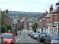
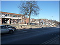
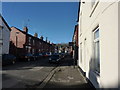
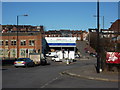
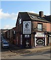
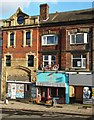
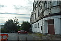
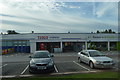
99 photos from this area
Area Information
Key information about the S7 2DL including its size, population, and administrative classification.
- Area Type
- Postcode
- Area Size
- 9590 m²
- Population
- 1611
- Population Density
- 7897 people/km²
House Prices in S7 2DL
27
Properties
£277,958
Average Sold Price
£72,000
Lowest Price
£430,000
Highest Price
Showing 27 properties
| Address | Type | Beds | Baths | Last Sale Price | Last Sale Date | |
|---|---|---|---|---|---|---|
| 18 Bannerdale Road, Sheffield, S7 2DL | Semi-detached | 5 | 2 | £430,000 | Mar 2021 | |
| 14 Bannerdale Road, Sheffield, S7 2DL | Semi-detached | 4 | 2 | £393,000 | Jul 2019 | |
| 16 Bannerdale Road, Sheffield, S7 2DL | house | - | - | £380,000 | Jan 2016 | |
| 24 Bannerdale Road, Sheffield, S7 2DL | Semi-detached | 5 | - | £317,000 | Sep 2014 | |
| 36 Bannerdale Road, Sheffield, S7 2DL | Semi-detached | 4 | - | £275,000 | Apr 2014 | |
| St Oswalds Vicarage, 2 Bannerdale Road, Sheffield, S7 2DL | Detached | 8 | 2 | £272,500 | Oct 2013 | |
| 34 Bannerdale Road, Sheffield, S7 2DL | Semi-detached | 5 | 2 | £262,500 | Aug 2013 | |
| 20 Bannerdale Road, Sheffield, S7 2DL | house | - | - | £275,000 | Jan 2009 | |
| 38 Bannerdale Road, Sheffield, S7 2DL | house | - | - | £249,950 | Nov 2007 | |
| 32 Bannerdale Road, Sheffield, S7 2DL | house | - | - | £250,000 | Nov 2005 |
Page 1 of 3
Energy Efficiency in S7 2DL
Amenities
Schools
| Rank | School | Type | Entry gender | Ages |
|---|
Explore more schools in this area
Go to Schools tabDemographics
Household Size
Two person
most common
Accommodation Type
Houses
most common
Tenure
61
majority
Ethnic Group
White
most common
Religion
N/A
most common
Household Composition
N/A
most common
Age
47
median
Adults (30-64 years)
most common
Household Deprivation
N/A
with no deprivation
NS-SEC
42
in Lower managerial occupations
Explore more demographic insights in this area
Go to Demographics tabPlanning
Planning Constraints
- Flood RiskPremium
- Ramsar Wetland SitesPremium
- Area of Outstanding Natural BeautyPremium
- Protected Nature ReservePremium
- Protected WoodlandPremium