Area Overview for S7 2BJ
Photos of S7 2BJ

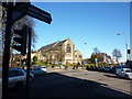
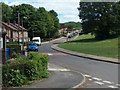
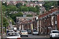
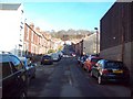


100 photos from this area
Area Information
Key information about the S7 2BJ including its size, population, and administrative classification.
- Area Type
- Postcode
- Area Size
- 6953 m²
- Population
- 1971
- Population Density
- 2864 people/km²
House Prices in S7 2BJ
23
Properties
£130,645
Average Sold Price
£44,950
Lowest Price
£260,000
Highest Price
Showing 23 properties
| Address | Type | Beds | Baths | Last Sale Price | Last Sale Date | |
|---|---|---|---|---|---|---|
| 909 Abbeydale Road, Sheffield, S7 2BJ | Terraced | 3 | 1 | £260,000 | Mar 2025 | |
| 903 Abbeydale Road, Sheffield, S7 2BJ | Terraced | 4 | 2 | £240,000 | Nov 2020 | |
| 911 Abbeydale Road, Sheffield, S7 2BJ | house | - | - | £125,000 | Jan 2016 | |
| 913 Abbeydale Road, Sheffield, S7 2BJ | house | - | - | £130,000 | Sep 2015 | |
| 905 Abbeydale Road, Sheffield, S7 2BJ | house | 3 | - | £120,000 | Feb 2013 | |
| 899 Abbeydale Road, Sheffield, S7 2BJ | Terraced | 3 | 1 | £125,000 | Aug 2010 | |
| 901 Abbeydale Road, Sheffield, S7 2BJ | Terraced | - | - | £120,000 | May 2009 | |
| 915 Abbeydale Road, Sheffield, S7 2BJ | house | - | - | £59,000 | Oct 2001 | |
| 919A Abbeydale Road, Sheffield, S7 2BJ | Maisonette | - | - | £82,500 | Jun 2001 | |
| 907 Abbeydale Road, Sheffield, S7 2BJ | Terraced | - | - | £44,950 | Jun 1999 |
Page 1 of 3
Energy Efficiency in S7 2BJ
Amenities
Schools
| Rank | School | Type | Entry gender | Ages |
|---|
Explore more schools in this area
Go to Schools tabDemographics
Household Size
Family (3-5 people)
most common
Accommodation Type
Houses
most common
Tenure
87
majority
Ethnic Group
White
most common
Religion
N/A
most common
Household Composition
N/A
most common
Age
47
median
Adults (30-64 years)
most common
Household Deprivation
N/A
with no deprivation
NS-SEC
61
in Lower managerial occupations
Explore more demographic insights in this area
Go to Demographics tabPlanning
Planning Constraints
- Flood RiskPremium
- Ramsar Wetland SitesPremium
- Area of Outstanding Natural BeautyPremium
- Protected Nature ReservePremium
- Protected WoodlandPremium