Area Overview for S66 8RH
Photos of S66 8RH


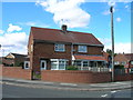
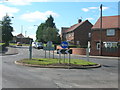
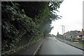


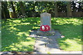
29 photos from this area
Area Information
Key information about the S66 8RH including its size, population, and administrative classification.
- Area Type
- Postcode
- Area Size
- 1.7 hectares
- Population
- 1278
- Population Density
- 5578 people/km²
House Prices in S66 8RH
43
Properties
£137,783
Average Sold Price
£80,000
Lowest Price
£235,000
Highest Price
Showing 43 properties
| Address | Type | Beds | Baths | Last Sale Price | Last Sale Date | |
|---|---|---|---|---|---|---|
| 109 Yarwell Drive, Maltby, Rotherham, S66 8RH | Detached | 3 | 1 | £215,000 | Dec 2024 | |
| 115 Yarwell Drive, Maltby, Rotherham, S66 8RH | Semi-detached | 2 | 1 | £145,000 | Jul 2024 | |
| 99 Yarwell Drive, Maltby, Rotherham, S66 8RH | Semi-detached | 2 | 1 | £122,500 | Apr 2024 | |
| 77 Yarwell Drive, Maltby, Rotherham, S66 8RH | Detached | 4 | 2 | £225,000 | Feb 2023 | |
| 87 Yarwell Drive, Maltby, Rotherham, S66 8RH | house | - | - | £127,000 | Sep 2022 | |
| 33 Yarwell Drive, Maltby, Rotherham, S66 8RH | Detached | 3 | 1 | £200,000 | Apr 2022 | |
| 43 Yarwell Drive, Maltby, Rotherham, S66 8RH | house | - | - | £173,000 | Oct 2021 | |
| 125 Yarwell Drive, Maltby, Rotherham, S66 8RH | Terraced | 2 | 1 | £88,000 | Oct 2019 | |
| 41 Yarwell Drive, Maltby, Rotherham, S66 8RH | Semi-detached | 4 | - | £161,000 | Sep 2018 | |
| 47 Yarwell Drive, Maltby, Rotherham, S66 8RH | Detached | 4 | - | £235,000 | Sep 2018 |
Page 1 of 5
Energy Efficiency in S66 8RH
Amenities
Schools
| Rank | School | Type | Entry gender | Ages |
|---|
Explore more schools in this area
Go to Schools tabDemographics
Household Size
Two person
most common
Accommodation Type
Houses
most common
Tenure
86
majority
Ethnic Group
White
most common
Religion
N/A
most common
Household Composition
N/A
most common
Age
47
median
Adults (30-64 years)
most common
Household Deprivation
N/A
with no deprivation
NS-SEC
28
in Lower managerial occupations
Explore more demographic insights in this area
Go to Demographics tabPlanning
Planning Constraints
- Flood RiskPremium
- Ramsar Wetland SitesPremium
- Area of Outstanding Natural BeautyPremium
- Protected Nature ReservePremium
- Protected WoodlandPremium