Area Overview for S66 8BP
Photos of S66 8BP
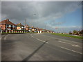

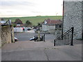
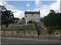

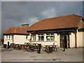
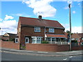
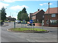
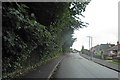
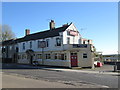

29 photos from this area
Area Information
Key information about the S66 8BP including its size, population, and administrative classification.
- Area Type
- Postcode
- Area Size
- 9300 m²
- Population
- 1505
- Population Density
- 4303 people/km²
House Prices in S66 8BP
22
Properties
£136,493
Average Sold Price
£47,000
Lowest Price
£300,000
Highest Price
Showing 22 properties
| Address | Type | Beds | Baths | Last Sale Price | Last Sale Date | |
|---|---|---|---|---|---|---|
| 1 Upperfield Close, Maltby, Rotherham, S66 8BP | Bungalow | - | - | £175,000 | Aug 2025 | |
| 8 Upperfield Close, Maltby, Rotherham, S66 8BP | Semi-detached | 3 | 1 | £150,000 | Apr 2023 | |
| 34 Upperfield Close, Maltby, Rotherham, S66 8BP | house | - | - | £300,000 | Nov 2021 | |
| 4 Upperfield Close, Maltby, Rotherham, S66 8BP | house | 3 | - | £98,000 | Jan 2021 | |
| 7 Upperfield Close, Maltby, Rotherham, S66 8BP | Detached | 3 | 1 | £155,000 | Nov 2020 | |
| 6 Upperfield Close, Maltby, Rotherham, S66 8BP | house | 3 | - | £117,500 | Jul 2012 | |
| 11 Upperfield Close, Maltby, Rotherham, S66 8BP | house | - | - | £134,000 | Sep 2009 | |
| 5 Upperfield Close, Maltby, Rotherham, S66 8BP | Detached | 3 | 1 | £117,500 | Jun 2009 | |
| 10 Upperfield Close, Maltby, Rotherham, S66 8BP | house | - | - | £140,000 | Jan 2005 | |
| 32 Upperfield Close, Maltby, Rotherham, S66 8BP | house | - | - | £159,950 | Dec 2003 |
Page 1 of 3
Energy Efficiency in S66 8BP
Amenities
Schools
| Rank | School | Type | Entry gender | Ages |
|---|
Explore more schools in this area
Go to Schools tabDemographics
Household Size
Family (3-5 people)
most common
Accommodation Type
Houses
most common
Tenure
62
majority
Ethnic Group
White
most common
Religion
N/A
most common
Household Composition
N/A
most common
Age
47
median
Adults (30-64 years)
most common
Household Deprivation
N/A
with no deprivation
NS-SEC
22
in Lower managerial occupations
Explore more demographic insights in this area
Go to Demographics tabPlanning
Planning Constraints
- Flood RiskPremium
- Ramsar Wetland SitesPremium
- Area of Outstanding Natural BeautyPremium
- Protected Nature ReservePremium
- Protected WoodlandPremium