Area Overview for S66 2DD
Photos of S66 2DD
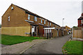
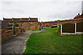
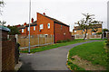
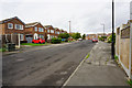
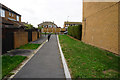
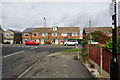
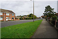

20 photos from this area
Area Information
Key information about the S66 2DD including its size, population, and administrative classification.
- Area Type
- Postcode
- Area Size
- 12.6 hectares
- Population
- 1415
- Population Density
- 635 people/km²
House Prices in S66 2DD
60
Properties
£156,832
Average Sold Price
£42,000
Lowest Price
£323,000
Highest Price
Showing 60 properties
| Address | Type | Beds | Baths | Last Sale Price | Last Sale Date | |
|---|---|---|---|---|---|---|
| 70 Green Lane, Wickersley, Rotherham, S66 2DD | Semi-detached | 3 | 1 | £323,000 | Oct 2024 | |
| 81 Green Lane, Wickersley, Rotherham, S66 2DD | Semi-detached | 3 | 1 | £200,000 | Mar 2024 | |
| 97 Green Lane, Wickersley, Rotherham, S66 2DD | Semi-detached | 3 | 1 | £240,000 | Feb 2023 | |
| 57 Green Lane, Wickersley, Rotherham, S66 2DD | house | - | - | £210,000 | Jan 2023 | |
| 39 Green Lane, Wickersley, Rotherham, S66 2DD | house | - | - | £183,000 | Jun 2022 | |
| 100 Green Lane, Wickersley, Rotherham, S66 2DD | Semi-detached | 3 | - | £248,000 | Dec 2019 | |
| 89 Green Lane, Wickersley, Rotherham, S66 2DD | house | - | - | £150,000 | May 2019 | |
| 63 Green Lane, Wickersley, Rotherham, S66 2DD | house | 3 | - | £200,000 | Aug 2016 | |
| 80 Green Lane, Wickersley, Rotherham, S66 2DD | Semi-detached | 3 | - | £175,000 | May 2016 | |
| 56 Green Lane, Wickersley, Rotherham, S66 2DD | Semi-detached | 3 | - | £122,000 | Sep 2014 |
Page 1 of 6
Energy Efficiency in S66 2DD
Amenities
Schools
| Rank | School | Type | Entry gender | Ages |
|---|
Explore more schools in this area
Go to Schools tabDemographics
Household Size
Two person
most common
Accommodation Type
Houses
most common
Tenure
68
majority
Ethnic Group
White
most common
Religion
N/A
most common
Household Composition
N/A
most common
Age
47
median
Adults (30-64 years)
most common
Household Deprivation
N/A
with no deprivation
NS-SEC
37
in Lower managerial occupations
Explore more demographic insights in this area
Go to Demographics tabPlanning
Planning Constraints
- Flood RiskPremium
- Ramsar Wetland SitesPremium
- Area of Outstanding Natural BeautyPremium
- Protected Nature ReservePremium
- Protected WoodlandPremium