Area Overview for S66 1JP
Photos of S66 1JP
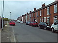
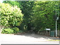
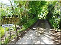
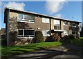
17 photos from this area
Area Information
Key information about the S66 1JP including its size, population, and administrative classification.
- Area Type
- Postcode
- Area Size
- 4.1 hectares
- Population
- 1795
- Population Density
- 3940 people/km²
House Prices in S66 1JP
42
Properties
£236,978
Average Sold Price
£34,500
Lowest Price
£548,000
Highest Price
Showing 42 properties
| Address | Type | Beds | Baths | Last Sale Price | Last Sale Date | |
|---|---|---|---|---|---|---|
| 49 Lings Lane, Wickersley, Rotherham, S66 1JP | Semi-detached | 2 | 1 | £218,000 | Dec 2024 | |
| 8 Lings Lane, Wickersley, Rotherham, S66 1JP | Detached | 4 | 2 | £548,000 | Jul 2024 | |
| 27 Lings Lane, Wickersley, Rotherham, S66 1JP | Terraced | 3 | 1 | £360,101 | Dec 2023 | |
| Thornfield, Lings Lane, Wickersley, Rotherham, S66 1JP | Detached | 4 | 3 | £450,000 | Mar 2022 | |
| 7 Lings Lane, Wickersley, Rotherham, S66 1JP | Semi-detached | 3 | 2 | £265,000 | Apr 2020 | |
| Helmar, Lings Lane, Wickersley, Rotherham, S66 1JP | Bungalow | 3 | - | £290,000 | Sep 2019 | |
| 17 Lings Lane, Wickersley, Rotherham, S66 1JP | Cottage | 3 | 1 | £227,000 | Jun 2018 | |
| 21 Lings Lane, Wickersley, Rotherham, S66 1JP | Cottage | 2 | 1 | £120,000 | Mar 2016 | |
| The Mallings, Lings Lane, Wickersley, Rotherham, S66 1JP | Bungalow | 3 | - | £292,500 | Sep 2014 | |
| 23 Lings Lane, Wickersley, Rotherham, S66 1JP | house | 2 | - | £135,000 | Apr 2014 |
Page 1 of 5
Energy Efficiency in S66 1JP
Amenities
Schools
| Rank | School | Type | Entry gender | Ages |
|---|
Explore more schools in this area
Go to Schools tabDemographics
Household Size
Family (3-5 people)
most common
Accommodation Type
Houses
most common
Tenure
76
majority
Ethnic Group
White
most common
Religion
N/A
most common
Household Composition
N/A
most common
Age
47
median
Adults (30-64 years)
most common
Household Deprivation
N/A
with no deprivation
NS-SEC
33
in Lower managerial occupations
Explore more demographic insights in this area
Go to Demographics tabPlanning
Planning Constraints
- Flood RiskPremium
- Ramsar Wetland SitesPremium
- Area of Outstanding Natural BeautyPremium
- Protected Nature ReservePremium
- Protected WoodlandPremium