Area Overview for S66 1BN
Photos of S66 1BN
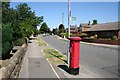
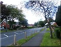
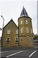
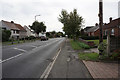
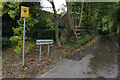
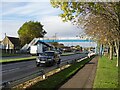
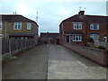
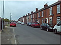
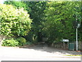
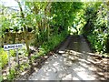
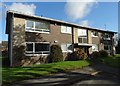
17 photos from this area
Area Information
Key information about the S66 1BN including its size, population, and administrative classification.
- Area Type
- Postcode
- Area Size
- 4.8 hectares
- Population
- 1795
- Population Density
- 3940 people/km²
House Prices in S66 1BN
41
Properties
£360,000
Average Sold Price
£310,000
Lowest Price
£497,000
Highest Price
Showing 41 properties
| Address | Type | Beds | Baths | Last Sale Price | Last Sale Date | |
|---|---|---|---|---|---|---|
| 44 Melhaven Way, Wickersley, Rotherham, S66 1BN | Detached | 5 | 3 | £497,000 | Dec 2023 | |
| 5 Melhaven Way, Wickersley, Rotherham, S66 1BN | Detached | 4 | 2 | £323,000 | May 2023 | |
| 62 Melhaven Way, Wickersley, Rotherham, S66 1BN | Detached | 4 | 1 | £350,000 | Apr 2022 | |
| 54 Melhaven Way, Wickersley, Rotherham, S66 1BN | Detached | 4 | 2 | £310,000 | Jul 2020 | |
| 4 Melhaven Way, Wickersley, Rotherham, S66 1BN | Detached | 4 | 2 | £385,000 | Aug 2019 | |
| 7 Melhaven Way, Wickersley, Rotherham, S66 1BN | Detached | 4 | 2 | £345,000 | May 2018 | |
| 17 Melhaven Way, Wickersley, Rotherham, S66 1BN | Detached | 3 | 1 | £310,000 | Nov 2017 | |
| 38 Melhaven Way, Wickersley, Rotherham, S66 1BN | Detached | 5 | 3 | - | - | |
| 11 Melhaven Way, Wickersley, Rotherham, S66 1BN | Detached | 4 | 2 | - | - | |
| 20 Melhaven Way, Wickersley, Rotherham, S66 1BN | Detached | 4 | 2 | - | - |
Page 1 of 5
Energy Efficiency in S66 1BN
Amenities
Schools
| Rank | School | Type | Entry gender | Ages |
|---|
Explore more schools in this area
Go to Schools tabDemographics
Household Size
Family (3-5 people)
most common
Accommodation Type
Houses
most common
Tenure
76
majority
Ethnic Group
White
most common
Religion
N/A
most common
Household Composition
N/A
most common
Age
47
median
Adults (30-64 years)
most common
Household Deprivation
N/A
with no deprivation
NS-SEC
33
in Lower managerial occupations
Explore more demographic insights in this area
Go to Demographics tabPlanning
Planning Constraints
- Flood RiskPremium
- Ramsar Wetland SitesPremium
- Area of Outstanding Natural BeautyPremium
- Protected Nature ReservePremium
- Protected WoodlandPremium