Area Overview for S61 2SW
Photos of S61 2SW
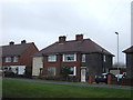
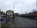
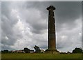

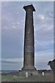
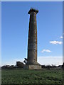
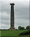
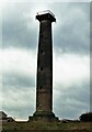
18 photos from this area
Area Information
Key information about the S61 2SW including its size, population, and administrative classification.
- Area Type
- Postcode
- Area Size
- 5.8 hectares
- Population
- 1445
- Population Density
- 398 people/km²
House Prices in S61 2SW
50
Properties
£219,172
Average Sold Price
£40,000
Lowest Price
£535,000
Highest Price
Showing 50 properties
| Address | Type | Beds | Baths | Last Sale Price | Last Sale Date | |
|---|---|---|---|---|---|---|
| 19 Admirals Crest, Scholes, Rotherham, S61 2SW | Detached | 4 | 2 | £395,000 | Sep 2025 | |
| 63 Admirals Crest, Scholes, Rotherham, S61 2SW | house | - | - | £305,000 | Jun 2025 | |
| 29 Admirals Crest, Scholes, Rotherham, S61 2SW | Bungalow | - | - | £270,000 | Jan 2024 | |
| 20 Admirals Crest, Scholes, Rotherham, S61 2SW | Bungalow | - | - | £295,000 | Mar 2023 | |
| 3 Admirals Crest, Scholes, Rotherham, S61 2SW | Detached | 3 | - | £235,000 | Dec 2022 | |
| 15 Admirals Crest, Scholes, Rotherham, S61 2SW | house | - | - | £325,000 | Dec 2022 | |
| 10 Admirals Crest, Scholes, Rotherham, S61 2SW | house | - | - | £535,000 | Oct 2022 | |
| 22 Admirals Crest, Scholes, Rotherham, S61 2SW | Bungalow | 2 | 1 | £225,000 | Jun 2022 | |
| 12 Admirals Crest, Scholes, Rotherham, S61 2SW | Detached | 4 | 2 | £425,000 | Jun 2021 | |
| 59 Admirals Crest, Scholes, Rotherham, S61 2SW | house | - | - | £265,000 | Nov 2020 |
Page 1 of 5
Energy Efficiency in S61 2SW
Amenities
Schools
| Rank | School | Type | Entry gender | Ages |
|---|
Explore more schools in this area
Go to Schools tabDemographics
Household Size
Two person
most common
Accommodation Type
Houses
most common
Tenure
84
majority
Ethnic Group
White
most common
Religion
N/A
most common
Household Composition
N/A
most common
Age
47
median
Adults (30-64 years)
most common
Household Deprivation
N/A
with no deprivation
NS-SEC
41
in Lower managerial occupations
Explore more demographic insights in this area
Go to Demographics tabPlanning
Planning Constraints
- Flood RiskPremium
- Ramsar Wetland SitesPremium
- Area of Outstanding Natural BeautyPremium
- Protected Nature ReservePremium
- Protected WoodlandPremium