Area Overview for S61 2QY
Photos of S61 2QY
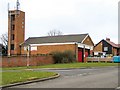
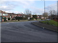
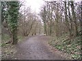
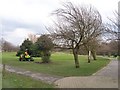
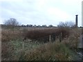
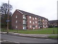
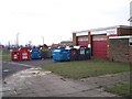
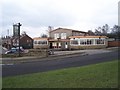


18 photos from this area
Area Information
Key information about the S61 2QY including its size, population, and administrative classification.
- Area Type
- Postcode
- Area Size
- 2.0 hectares
- Population
- 1445
- Population Density
- 398 people/km²
House Prices in S61 2QY
61
Properties
£140,592
Average Sold Price
£41,500
Lowest Price
£375,000
Highest Price
Showing 61 properties
| Address | Type | Beds | Baths | Last Sale Price | Last Sale Date | |
|---|---|---|---|---|---|---|
| 38 Hesley Grange, Scholes, Rotherham, S61 2QY | Detached | 4 | 1 | £253,000 | Aug 2024 | |
| 33 Hesley Grange, Scholes, Rotherham, S61 2QY | Detached | 5 | 1 | £210,000 | Mar 2024 | |
| 22 Hesley Grange, Scholes, Rotherham, S61 2QY | Semi-detached | 2 | 1 | £119,000 | Jan 2024 | |
| Kingslea, 69 Hesley Grange, Scholes, Rotherham, S61 2QY | Retail | 4 | 3 | £375,000 | Oct 2022 | |
| 30 Hesley Grange, Scholes, Rotherham, S61 2QY | house | - | - | £185,000 | Sep 2021 | |
| 48 Hesley Grange, Scholes, Rotherham, S61 2QY | Terraced | 2 | 1 | £116,000 | Feb 2021 | |
| 25 Hesley Grange, Scholes, Rotherham, S61 2QY | Semi-detached | 2 | - | £143,000 | Nov 2020 | |
| 8 Hesley Grange, Scholes, Rotherham, S61 2QY | Semi-detached | 2 | 1 | £137,000 | Jul 2020 | |
| 52 Hesley Grange, Scholes, Rotherham, S61 2QY | Detached | 4 | 1 | £290,000 | May 2020 | |
| 44 Hesley Grange, Scholes, Rotherham, S61 2QY | house | - | - | £110,000 | Nov 2013 |
Page 1 of 7
Energy Efficiency in S61 2QY
Amenities
Schools
| Rank | School | Type | Entry gender | Ages |
|---|
Explore more schools in this area
Go to Schools tabDemographics
Household Size
Two person
most common
Accommodation Type
Houses
most common
Tenure
84
majority
Ethnic Group
White
most common
Religion
N/A
most common
Household Composition
N/A
most common
Age
47
median
Adults (30-64 years)
most common
Household Deprivation
N/A
with no deprivation
NS-SEC
41
in Lower managerial occupations
Explore more demographic insights in this area
Go to Demographics tabPlanning
Planning Constraints
- Flood RiskPremium
- Ramsar Wetland SitesPremium
- Area of Outstanding Natural BeautyPremium
- Protected Nature ReservePremium
- Protected WoodlandPremium