Area Overview for S6 5QQ
Photos of S6 5QQ
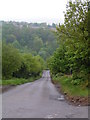
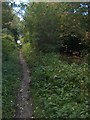
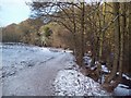
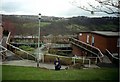
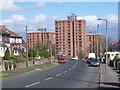
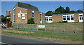
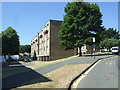
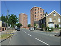
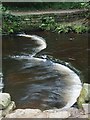
53 photos from this area
Area Information
Key information about the S6 5QQ including its size, population, and administrative classification.
- Area Type
- Postcode
- Area Size
- 7982 m²
- Population
- 1504
- Population Density
- 7259 people/km²
House Prices in S6 5QQ
24
Properties
£194,107
Average Sold Price
£22,000
Lowest Price
£322,000
Highest Price
Showing 24 properties
| Address | Type | Beds | Baths | Last Sale Price | Last Sale Date | |
|---|---|---|---|---|---|---|
| 414 Stannington Road, Sheffield, S6 5QQ | Detached | 3 | 1 | £256,000 | Aug 2025 | |
| 416 Stannington Road, Sheffield, S6 5QQ | Semi-detached | 3 | 1 | £260,000 | Jun 2025 | |
| 408 Stannington Road, Sheffield, S6 5QQ | Semi-detached | 3 | 2 | £322,000 | Mar 2025 | |
| 398 Stannington Road, Sheffield, S6 5QQ | Detached | 3 | 1 | £279,500 | Aug 2023 | |
| 412 Stannington Road, Sheffield, S6 5QQ | Retail | 3 | 1 | £280,000 | Aug 2022 | |
| 420 Stannington Road, Sheffield, S6 5QQ | Semi-detached | 3 | 1 | £210,000 | Jun 2021 | |
| 432-434 Stannington Road, Sheffield, S6 5QQ | Cottage | 4 | - | £180,000 | Nov 2019 | |
| 396 Stannington Road, Sheffield, S6 5QQ | house | - | - | £22,000 | Sep 2015 | |
| 394 Stannington Road, Sheffield, S6 5QQ | Semi-detached | 3 | 1 | £185,000 | Nov 2014 | |
| 428 Stannington Road, Sheffield, S6 5QQ | Terraced | 3 | - | £120,000 | Jul 2014 |
Page 1 of 3
Energy Efficiency in S6 5QQ
Amenities
Schools
| Rank | School | Type | Entry gender | Ages |
|---|
Explore more schools in this area
Go to Schools tabDemographics
Household Size
One person
most common
Accommodation Type
Houses
most common
Tenure
42
majority
Ethnic Group
White
most common
Religion
N/A
most common
Household Composition
N/A
most common
Age
47
median
Adults (30-64 years)
most common
Household Deprivation
N/A
with no deprivation
NS-SEC
21
in Lower managerial occupations
Explore more demographic insights in this area
Go to Demographics tabPlanning
Planning Constraints
- Flood RiskPremium
- Ramsar Wetland SitesPremium
- Area of Outstanding Natural BeautyPremium
- Protected Nature ReservePremium
- Protected WoodlandPremium