Area Overview for S6 5LU
Photos of S6 5LU
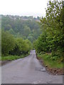
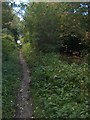
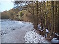
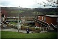
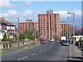
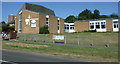
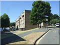
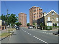
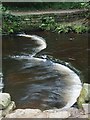
53 photos from this area
Area Information
Key information about the S6 5LU including its size, population, and administrative classification.
- Area Type
- Postcode
- Area Size
- 1.0 hectares
- Population
- 1583
- Population Density
- 4154 people/km²
House Prices in S6 5LU
50
Properties
£88,544
Average Sold Price
£55,000
Lowest Price
£119,950
Highest Price
Showing 50 properties
| Address | Type | Beds | Baths | Last Sale Price | Last Sale Date | |
|---|---|---|---|---|---|---|
| 64 Woodfarm Close, Sheffield, S6 5LU | Maisonette | 2 | 1 | £105,000 | Jan 2023 | |
| 12 Woodfarm Close, Sheffield, S6 5LU | Maisonette | - | - | £87,500 | Nov 2020 | |
| 15 Woodfarm Close, Sheffield, S6 5LU | house | - | - | £90,000 | Nov 2011 | |
| 34 Woodfarm Close, Sheffield, S6 5LU | Maisonette | 2 | - | £55,000 | Feb 2011 | |
| 21 Woodfarm Close, Sheffield, S6 5LU | house | 3 | - | £61,000 | Apr 2010 | |
| 62 Woodfarm Close, Sheffield, S6 5LU | Maisonette | - | - | £69,500 | Sep 2009 | |
| 23 Woodfarm Close, Sheffield, S6 5LU | house | - | - | £104,950 | Feb 2008 | |
| 11 Woodfarm Close, Sheffield, S6 5LU | house | 3 | - | £119,950 | Jan 2008 | |
| 1 Woodfarm Close, Sheffield, S6 5LU | Terraced | - | - | £104,000 | Jul 2007 | |
| 5 Woodfarm Close, Sheffield, S6 5LU | house | 3 | - | - | - |
Page 1 of 5
Energy Efficiency in S6 5LU
Amenities
Schools
| Rank | School | Type | Entry gender | Ages |
|---|
Explore more schools in this area
Go to Schools tabDemographics
Household Size
Two person
most common
Accommodation Type
Houses
most common
Tenure
87
majority
Ethnic Group
White
most common
Religion
N/A
most common
Household Composition
N/A
most common
Age
47
median
Adults (30-64 years)
most common
Household Deprivation
N/A
with no deprivation
NS-SEC
34
in Lower managerial occupations
Explore more demographic insights in this area
Go to Demographics tabPlanning
Planning Constraints
- Flood RiskPremium
- Ramsar Wetland SitesPremium
- Area of Outstanding Natural BeautyPremium
- Protected Nature ReservePremium
- Protected WoodlandPremium