Area Overview for S6 5JH
Photos of S6 5JH
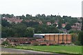
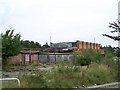
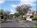
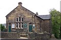
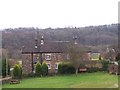
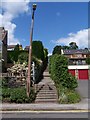
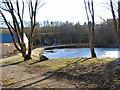
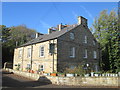
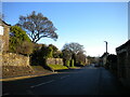
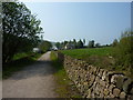
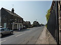
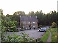
75 photos from this area
Area Information
Key information about the S6 5JH including its size, population, and administrative classification.
- Area Type
- Postcode
- Area Size
- 21.3 hectares
- Population
- 1638
- Population Density
- 108 people/km²
House Prices in S6 5JH
12
Properties
£575,843
Average Sold Price
£467,500
Lowest Price
£679,215
Highest Price
Showing 12 properties
| Address | Type | Beds | Baths | Last Sale Price | Last Sale Date | |
|---|---|---|---|---|---|---|
| 100 Myers Grove Lane, Sheffield, S6 5JH | Detached | 4 | 4 | £679,215 | Aug 2023 | |
| Former 102, Myers Grove Lane, Sheffield, S6 5JH | Detached | 3 | 1 | £467,500 | Jun 2023 | |
| 102 Myers Grove Lane, Sheffield, S6 5JH | Terraced | - | - | £467,500 | Jun 2023 | |
| 104 Myers Grove Lane, Sheffield, S6 5JH | house | - | - | £600,000 | Jun 2023 | |
| Greystones, Myers Grove Lane, Sheffield, S6 5JH | house | 6 | - | £665,000 | May 2012 | |
| Broadhead Rise, Myers Grove Lane, Sheffield, S6 5JH | Detached | - | - | - | - | |
| Broadhead Flatts Farm, Myers Grove Lane, Sheffield, S6 5JH | Detached | - | - | - | - | |
| Pinegrove Country Club Flat, Myers Grove Lane, Sheffield, S6 5JH | Flat | - | - | - | - | |
| Sheffield Sports And Social Club, Sheffield Sports And Social Club Football Pitches, Myers Grove Lane, Sheffield, S6 5JH | Leisure | - | - | - | - | |
| Building Adjacent Loxley Bank 120, Myers Grove Lane, Sheffield, S6 5JH | Semi-detached | - | - | - | - |
Page 1 of 2
Energy Efficiency in S6 5JH
Amenities
Schools
| Rank | School | Type | Entry gender | Ages |
|---|
Explore more schools in this area
Go to Schools tabDemographics
Household Size
Two person
most common
Accommodation Type
Houses
most common
Tenure
85
majority
Ethnic Group
White
most common
Religion
N/A
most common
Household Composition
N/A
most common
Age
47
median
Adults (30-64 years)
most common
Household Deprivation
N/A
with no deprivation
NS-SEC
44
in Lower managerial occupations
Explore more demographic insights in this area
Go to Demographics tabPlanning
Planning Constraints
- Flood RiskPremium
- Ramsar Wetland SitesPremium
- Area of Outstanding Natural BeautyPremium
- Protected Nature ReservePremium
- Protected WoodlandPremium