Area Overview for S6 4TH
Photos of S6 4TH
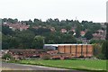
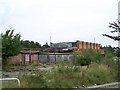
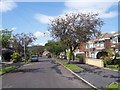
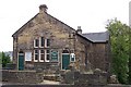
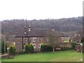
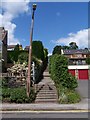
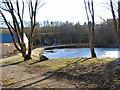
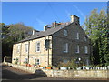
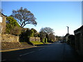
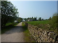
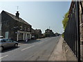
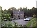
75 photos from this area
Area Information
Key information about the S6 4TH including its size, population, and administrative classification.
- Area Type
- Postcode
- Area Size
- 4.1 hectares
- Population
- 1659
- Population Density
- 3374 people/km²
House Prices in S6 4TH
23
Properties
£172,513
Average Sold Price
£40,000
Lowest Price
£270,000
Highest Price
Showing 23 properties
| Address | Type | Beds | Baths | Last Sale Price | Last Sale Date | |
|---|---|---|---|---|---|---|
| 337 Loxley Road, Sheffield, S6 4TH | Terraced | 3 | - | £225,000 | Jul 2025 | |
| 292 Loxley Road, Sheffield, S6 4TH | Semi-detached | 3 | 1 | £270,000 | Apr 2024 | |
| 288 Loxley Road, Sheffield, S6 4TH | house | - | - | £252,000 | Mar 2022 | |
| 335 Loxley Road, Sheffield, S6 4TH | Terraced | 3 | 1 | £210,075 | Feb 2022 | |
| 341 Loxley Road, Sheffield, S6 4TH | Terraced | 3 | - | £185,200 | Oct 2019 | |
| 347 Loxley Road, Sheffield, S6 4TH | Terraced | 3 | 1 | £155,000 | Feb 2018 | |
| 343 Loxley Road, Sheffield, S6 4TH | house | - | - | £145,000 | Aug 2016 | |
| 294 Loxley Road, Sheffield, S6 4TH | house | - | - | £193,500 | Aug 2015 | |
| 284 Loxley Road, Sheffield, S6 4TH | Bungalow | - | - | £250,000 | May 2015 | |
| 282 Loxley Road, Sheffield, S6 4TH | Semi-detached | 3 | - | £140,000 | Oct 2011 |
Page 1 of 3
Energy Efficiency in S6 4TH
Amenities
Schools
| Rank | School | Type | Entry gender | Ages |
|---|
Explore more schools in this area
Go to Schools tabDemographics
Household Size
Two person
most common
Accommodation Type
Houses
most common
Tenure
67
majority
Ethnic Group
White
most common
Religion
N/A
most common
Household Composition
N/A
most common
Age
47
median
Adults (30-64 years)
most common
Household Deprivation
N/A
with no deprivation
NS-SEC
36
in Lower managerial occupations
Explore more demographic insights in this area
Go to Demographics tabPlanning
Planning Constraints
- Flood RiskPremium
- Ramsar Wetland SitesPremium
- Area of Outstanding Natural BeautyPremium
- Protected Nature ReservePremium
- Protected WoodlandPremium