Area Overview for S35 9ZQ
Photos of S35 9ZQ
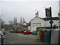
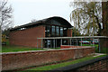
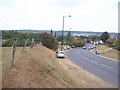
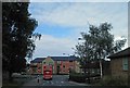
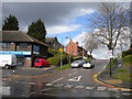
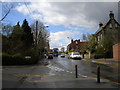
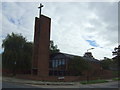
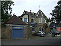
15 photos from this area
Area Information
Key information about the S35 9ZQ including its size, population, and administrative classification.
- Area Type
- Postcode
- Area Size
- 1.0 hectares
- Population
- 1522
- Population Density
- 3987 people/km²
House Prices in S35 9ZQ
74
Properties
£163,083
Average Sold Price
£90,500
Lowest Price
£220,000
Highest Price
Showing 74 properties
| Address | Type | Beds | Baths | Last Sale Price | Last Sale Date | |
|---|---|---|---|---|---|---|
| 1 Primrose Drive, Sheffield, S35 9ZQ | Semi-detached | 1 | 1 | £200,000 | Apr 2024 | |
| 17 Primrose Drive, Sheffield, S35 9ZQ | Semi-detached | 3 | 1 | £220,000 | Mar 2023 | |
| 3 Primrose Drive, Sheffield, S35 9ZQ | house | 2 | 1 | £215,000 | Apr 2022 | |
| 13 Primrose Drive, Sheffield, S35 9ZQ | Semi-detached | 3 | - | £130,000 | Jul 2018 | |
| 9 Primrose Drive, Sheffield, S35 9ZQ | Semi-detached | - | - | £123,000 | Apr 2007 | |
| 26 Primrose Drive, Sheffield, S35 9ZQ | Terraced | - | - | £90,500 | May 2005 | |
| 68, Regency Court, 39 Primrose Drive, Sheffield, S35 9ZQ | Flat | 1 | 1 | - | - | |
| 16, Regency Court, 39 Primrose Drive, Sheffield, S35 9ZQ | Flat | 1 | 1 | - | - | |
| 23, Regency Court, 39 Primrose Drive, Sheffield, S35 9ZQ | Flat | 1 | 1 | - | - | |
| 60, Regency Court, 39 Primrose Drive, Sheffield, S35 9ZQ | Flat | 2 | - | - | - |
Page 1 of 8
Energy Efficiency in S35 9ZQ
Amenities
Schools
| Rank | School | Type | Entry gender | Ages |
|---|
Explore more schools in this area
Go to Schools tabDemographics
Household Size
Two person
most common
Accommodation Type
Houses
most common
Tenure
68
majority
Ethnic Group
White
most common
Religion
N/A
most common
Household Composition
N/A
most common
Age
47
median
Adults (30-64 years)
most common
Household Deprivation
N/A
with no deprivation
NS-SEC
25
in Lower managerial occupations
Explore more demographic insights in this area
Go to Demographics tabPlanning
Planning Constraints
- Flood RiskPremium
- Ramsar Wetland SitesPremium
- Area of Outstanding Natural BeautyPremium
- Protected Nature ReservePremium
- Protected WoodlandPremium