Area Overview for S25 2TW
Photos of S25 2TW
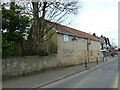
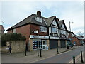
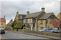
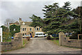
21 photos from this area
Area Information
Key information about the S25 2TW including its size, population, and administrative classification.
- Area Type
- Postcode
- Area Size
- 1.6 hectares
- Population
- 1180
- Population Density
- 4003 people/km²
House Prices in S25 2TW
43
Properties
£119,881
Average Sold Price
£27,000
Lowest Price
£233,000
Highest Price
Showing 43 properties
| Address | Type | Beds | Baths | Last Sale Price | Last Sale Date | |
|---|---|---|---|---|---|---|
| 28 Borrowdale Crescent, North Anston, Rotherham, S25 2TW | Bungalow | 2 | 1 | £151,000 | Jul 2024 | |
| 37 Borrowdale Crescent, North Anston, Rotherham, S25 2TW | Detached | 3 | 1 | £225,000 | Mar 2024 | |
| 38 Borrowdale Crescent, North Anston, Rotherham, S25 2TW | Semi-detached | 2 | 1 | £224,995 | Sep 2023 | |
| 25 Borrowdale Crescent, North Anston, Rotherham, S25 2TW | Semi-detached | 4 | 1 | £224,000 | Sep 2023 | |
| 32 Borrowdale Crescent, North Anston, Rotherham, S25 2TW | house | - | - | £137,500 | Nov 2020 | |
| 29 Borrowdale Crescent, North Anston, Rotherham, S25 2TW | Bungalow | - | - | £175,000 | Sep 2020 | |
| 46 Borrowdale Crescent, North Anston, Rotherham, S25 2TW | Semi-detached | 3 | 1 | £102,000 | Jul 2020 | |
| 40 Borrowdale Crescent, North Anston, Rotherham, S25 2TW | Semi-detached | 2 | 1 | £120,000 | Feb 2020 | |
| 12 Borrowdale Crescent, North Anston, Rotherham, S25 2TW | Bungalow | 5 | 2 | £233,000 | May 2018 | |
| 31 Borrowdale Crescent, North Anston, Rotherham, S25 2TW | Bungalow | 3 | 1 | £166,000 | Feb 2017 |
Page 1 of 5
Energy Efficiency in S25 2TW
Amenities
Schools
| Rank | School | Type | Entry gender | Ages |
|---|
Explore more schools in this area
Go to Schools tabDemographics
Household Size
Two person
most common
Accommodation Type
Houses
most common
Tenure
84
majority
Ethnic Group
White
most common
Religion
N/A
most common
Household Composition
N/A
most common
Age
47
median
Adults (30-64 years)
most common
Household Deprivation
N/A
with no deprivation
NS-SEC
31
in Lower managerial occupations
Explore more demographic insights in this area
Go to Demographics tabPlanning
Planning Constraints
- Flood RiskPremium
- Ramsar Wetland SitesPremium
- Area of Outstanding Natural BeautyPremium
- Protected Nature ReservePremium
- Protected WoodlandPremium