Area Overview for S25 2TS
Photos of S25 2TS
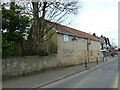
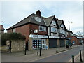
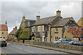
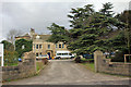
21 photos from this area
Area Information
Key information about the S25 2TS including its size, population, and administrative classification.
- Area Type
- Postcode
- Area Size
- 1.0 hectares
- Population
- 1180
- Population Density
- 4003 people/km²
House Prices in S25 2TS
19
Properties
£108,659
Average Sold Price
£59,950
Lowest Price
£137,000
Highest Price
Showing 19 properties
| Address | Type | Beds | Baths | Last Sale Price | Last Sale Date | |
|---|---|---|---|---|---|---|
| 12 Langdale Way, North Anston, Rotherham, S25 2TS | Detached | 2 | 1 | £135,000 | Jun 2021 | |
| 21 Langdale Way, North Anston, Rotherham, S25 2TS | Semi-detached | 2 | 1 | £125,000 | Aug 2020 | |
| 6 Langdale Way, North Anston, Rotherham, S25 2TS | Bungalow | 2 | - | £135,000 | Jan 2020 | |
| 3 Langdale Way, North Anston, Rotherham, S25 2TS | Bungalow | 2 | 1 | £137,000 | Apr 2019 | |
| 23 Langdale Way, North Anston, Rotherham, S25 2TS | Semi-detached | 3 | 1 | £123,800 | Apr 2017 | |
| 4 Langdale Way, North Anston, Rotherham, S25 2TS | Semi-detached | 2 | 1 | £124,250 | Jul 2016 | |
| 25 Langdale Way, North Anston, Rotherham, S25 2TS | Semi-detached | 2 | - | £102,137 | Mar 2014 | |
| 11 Langdale Way, North Anston, Rotherham, S25 2TS | house | 2 | - | £84,500 | Jul 2011 | |
| 19 Langdale Way, North Anston, Rotherham, S25 2TS | Detached | - | - | £59,950 | Jul 2000 | |
| 17 Langdale Way, North Anston, Rotherham, S25 2TS | Detached | 3 | 1 | £59,950 | Nov 1997 |
Page 1 of 2
Energy Efficiency in S25 2TS
Amenities
Schools
| Rank | School | Type | Entry gender | Ages |
|---|
Explore more schools in this area
Go to Schools tabDemographics
Household Size
Two person
most common
Accommodation Type
Houses
most common
Tenure
84
majority
Ethnic Group
White
most common
Religion
N/A
most common
Household Composition
N/A
most common
Age
47
median
Adults (30-64 years)
most common
Household Deprivation
N/A
with no deprivation
NS-SEC
31
in Lower managerial occupations
Explore more demographic insights in this area
Go to Demographics tabPlanning
Planning Constraints
- Flood RiskPremium
- Ramsar Wetland SitesPremium
- Area of Outstanding Natural BeautyPremium
- Protected Nature ReservePremium
- Protected WoodlandPremium