Area Overview for S10 1UN
Photos of S10 1UN
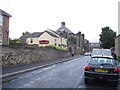
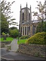
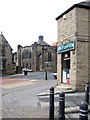
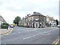
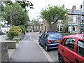
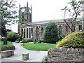
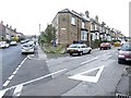
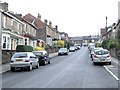
95 photos from this area
Area Information
Key information about the S10 1UN including its size, population, and administrative classification.
- Area Type
- Postcode
- Area Size
- 4138 m²
- Population
- 1296
- Population Density
- 11077 people/km²
House Prices in S10 1UN
22
Properties
£165,580
Average Sold Price
£46,000
Lowest Price
£355,000
Highest Price
Showing 22 properties
| Address | Type | Beds | Baths | Last Sale Price | Last Sale Date | |
|---|---|---|---|---|---|---|
| 70 Nairn Street, Sheffield, S10 1UN | Terraced | 3 | 2 | £268,500 | Feb 2025 | |
| 60 Nairn Street, Sheffield, S10 1UN | Terraced | 3 | 1 | £260,000 | Jan 2025 | |
| 61 Nairn Street, Sheffield, S10 1UN | Terraced | 4 | 1 | £275,000 | Dec 2024 | |
| 58 Nairn Street, Sheffield, S10 1UN | Terraced | 3 | 1 | £275,000 | Apr 2024 | |
| 78 Nairn Street, Sheffield, S10 1UN | Terraced | 3 | - | £355,000 | Mar 2024 | |
| 66 Nairn Street, Sheffield, S10 1UN | Terraced | 3 | 1 | £196,000 | Jun 2017 | |
| 77 Nairn Street, Sheffield, S10 1UN | Terraced | 3 | 1 | £220,000 | Sep 2016 | |
| 83 Nairn Street, Sheffield, S10 1UN | house | 3 | - | £165,000 | Feb 2016 | |
| 72 Nairn Street, Sheffield, S10 1UN | Terraced | 3 | 1 | £183,000 | Dec 2015 | |
| 74 Nairn Street, Sheffield, S10 1UN | Terraced | 3 | 1 | £158,500 | Aug 2014 |
Page 1 of 3
Energy Efficiency in S10 1UN
Amenities
Schools
| Rank | School | Type | Entry gender | Ages |
|---|
Explore more schools in this area
Go to Schools tabDemographics
Household Size
One person
most common
Accommodation Type
Houses
most common
Tenure
42
majority
Ethnic Group
White
most common
Religion
N/A
most common
Household Composition
N/A
most common
Age
47
median
Young Adults (15-29 years)
most common
Household Deprivation
N/A
with no deprivation
NS-SEC
38
in Lower managerial occupations
Explore more demographic insights in this area
Go to Demographics tabPlanning
Planning Constraints
- Flood RiskPremium
- Ramsar Wetland SitesPremium
- Area of Outstanding Natural BeautyPremium
- Protected Nature ReservePremium
- Protected WoodlandPremium