Area Overview for York
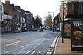
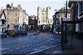
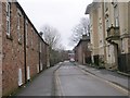
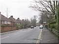
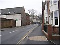
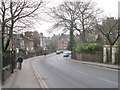
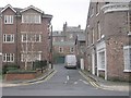
Photos of York

Area Information
York stands as a distinct built-up area covering 29.1 square kilometres, hosting a population of 44,325 residents. This density creates a population figure of 1,525 people per square kilometre, giving the town a compact character where daily life often involves walking or short local trips rather than long commutes. Living in York means existing within a space where the urban fabric is neither sprawling nor remotely isolated. The size of the municipality ensures that you are well-removed from the anonymity of large metropolises while retaining the infrastructure of a significant city. Daily life here revolves around accessibility to essential services within this defined boundary. You navigate a landscape designed for a population of roughly forty-four thousand individuals, which shapes everything from local shop provisions to community event scales. The area's classification as a built-up town or city reflects its historical roots, now managed for modern residential needs. Living in this location offers a specific quality of life defined by its manageable scale alongside high connectivity. When you consider homes in York, you are buying into a community where the average resident is surrounded by neighbours quickly accessible across a 29.1 square kilometre footprint. This spatial arrangement supports a lifestyle where public transport, local retail units, and schools are reachable without extensive travel. You do not require a car to sustain your daily routine, although one may be preferable for occasional longer journeys outside the immediate area. The population density supports a vibrant yet contained sense of community, distinct from the vast zones found in larger regions.
- Area Type
- Built Up Area 250
- Area Size
- 29.1 km²
- Population
- 44325
- Population Density
- 1525 people/km²
Daily life in York is supported by a network of practical amenities located within convenient reach of your property. Retail availability is strong, with five notable shopping locations identified for local residents. Sainsburys visits York, Sainsburys York, and Sainsburys Blossom are prominent among these, offering essential groceries and daily goods without the need for long drives. Having Supermarkets like Sainsburys so close means your weekly shopping can be completed quickly, fitting easily into a day-to-day schedule. These retail points form the backbone of local convenience, ensuring that food, household necessities, and daily goods are always accessible. In terms of travel infrastructure, access to five rail services further enhances your lifestyle by extending your daily radius effectively. York Railway Station is a key hub, facilitating easy journeys to other parts of England for holidays or business. Living here allows you to enjoy the benefits of urban amenities while maintaining a compact living space. You have immediate access to major supermarkets and frequent train departures, meaning your routine is streamlined. The area does not rely on vast parks or leisure centres in the data provided, but the concentration of retail services ensures a convenient shopping environment. If you value practicality in your home life, York delivers through these focused retail options. You will find that running errands is simple, with the main stations and large supermarket branches acting as the primary focal points for community activity. This layout supports a resident who values time efficiency and straightforward access to quality shopping.
Amenities
Schools
For families considering living in York, the nearest educational institutions provide a range of options for early years and primary education. Within a practical reach of the area, St Paul's Nursery School operates as a nursery, catering to the youngest children in the community. For primary education, Acomb Primary School and Carr Junior School serve the local vicinity, offering secondary schooling transitions for younger pupils. Carr Infant School is also available nearby and holds an Ofsted rating of "good," indicating a standard of performance that educational bodies recognise as solid. Danesgate Community is another institution listed in the local directory, operating under other educational classifications. The mix of school types reflects the needs of a town with a median age of 70, where primary education is the most prominent need among the population. Although primary and junior schools are accessible, secondary and tertiary education providers are not listed in the immediate data, suggesting families may commute further for older children. When planning your move, you have access to St Paul's Nursery School for pre-school preparation and a selection of primary schools such as Acomb Primary and Carr Infant. The presence of a "good" rated school like Carr Infant School offers reassurance for parents seeking a verified quality of education close to home. However, the absence of high school data in the immediate list means children of secondary age might require travel. You should verify further distances to high schools before settling, as the current data only confirms the presence of early years and primary facilities. Living in York provides these foundational educational resources directly within the 29.1 square kilometre boundary.
| Rank | School | Type | Entry gender | Ages |
|---|
Explore more schools in this area
Go to Schools tabDemographics
The demographic profile of York reveals a population of 44,325 people with a median age of 70 years. This statistic indicates that the average resident is a senior citizen, suggesting the area is heavily populated by older adults rather than young families or working-age professionals. The most common age range listed as "Total" underscores that the entire population falls into broad, undefined brackets when specific age segmentation data is not provided in this overview. With nearly two-thirds of the population owning their homes, home ownership stands at 61 percent. This figure suggests that you can expect most houses in the area to be owner-occupied rather than part of a rental market. Furthermore, the accommodation type data covers the total stock, implying a wide variety of property structures including detached, semi-detached, and terraced homes typical of historic British towns. The societal makeup of the area is heavily weighted towards older demographics, which influences the local infrastructure and service mix. A home ownership rate of 61 percent means that if you are looking to purchase, you are buying into a stable neighbourhood where residents have long-term ties to their properties. This stability often correlates with better-maintained suburbs and a sense of established community, contrasted with the transient nature of high-rental zones. While the entertainment of creating diverse community dynamics is possible, the current data points to a quieter environment suited to retirees and long-term settlers. You should understand that living in this area means engaging with a community where the median age defines the pace and priorities of local life. The household composition reflects these ownership patterns, suggesting fewer investor-dominated blocks and more families or individuals who have settled permanently for the long term.