Area Overview for North Yorkshire
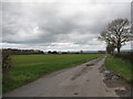
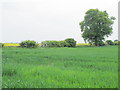
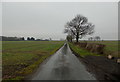
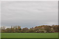
Photos of North Yorkshire


Area Information
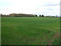
North Yorkshire stands as the largest ceremonial county in England, covering an extensive 8,685.6 km². You will find yourself stretching from the North Sea coast all the way to the Pennines, encompassing diverse landscapes that include rolling hills and significant moorland. This region forms part of the Yorkshire and the Humber area while also overlapping with North East England. Borders with County Durham, Cumbria, Lancashire, West Yorkshire, and the East Riding of Yorkshire define its unusual geography. Within these vast boundaries, you will discover dramatic coastlines, the Yorkshire Dales, and the North York Moors National Parks. Key settlements include Harrogate, Scarborough, and Whitby, but the administrative heart lies in Northallerton. The City of York also operates as a unitary authority within the region. Major towns such as Skipton offer historic charm, while Redcar provides coastal living near the泰斯 river mouth. Living in North Yorkshire means navigating a region that was established in 1974 under the Local Government Act 1972. The area maintains strong traditions, such as the annual Yorkshire Day celebration held on 1 August. From market towns to unitary authorities like Middlesbrough and Stockton-on-Tees, the county offers a wide variety of living environments. You can choose between the rugged North York Moors or the bustling urban centres. The sheer scale allows for numerous districts, meaning daily life varies subtly depending on your specific location within the 8,685.6 km² territory. For those seeking space and natural beauty, Northallerton serves as the primary hub for connecting these diverse communities efficiently.
- Area Type
- Ceremonial Counties Region
- Area Size
- 8685.6 km²
- Population
- Not available
- Population Density
- Not available
Demographics
The community in North Yorkshire reflects an older population compared to many other regions. The median age stands at 70 years, indicating a resident base that is significantly mature. Age data confirms this trend, showing that the total age distribution skews heavily towards seniors. Most households are likely headed by or consist of older individuals given the demographic profile. Home ownership is prevalent in this area, with 67% of residents owning their dwellings. This high rate suggests stability and long-term settlement rather than transient tenancy. The accommodation type data covers the total stock available across the county. While specific breakdowns of accommodation types are aggregated in the total figure, the high ownership rate implies a mix of established family homes and retirement properties. You will not find a young, transient workforce as common in London or the Southeast. Instead, the neighbourhoods are filled with established families and retirees who have called the area home for decades. The predominant ethnic group and religious affiliation data are available as totals, representing the broad makeup of the population. This stability contributes to a quiet, predictable lifestyle where neighbours often have known each other for a long time. Living in North Yorkshire offers a peaceful environment, though the lack of young families can limit access to very young children's amenities in some villages. The 67% ownership figure remains the strongest indicator of the area's character, defining it as a prime location for those seeking to stay rather than move frequently.