Area Overview for LS7 1AZ
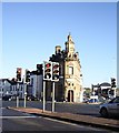
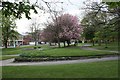
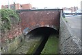
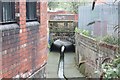
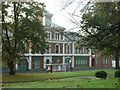
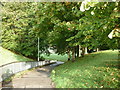
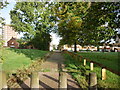
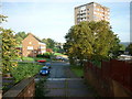
Photos of LS7 1AZ
Area Information
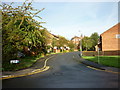
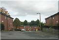
Living in LS7 1AZ means inhabiting a densely populated, small-scale residential cluster in England. The area covers just 3,589 square metres, yet it accommodates 2,293 residents, resulting in a population density of 638,861 people per square kilometre. This compact footprint suggests a tightly knit community, though the high density may influence the character of daily life. The area’s demographics reveal a young population, with a median age of 22 and a majority of residents aged 30–64. This suggests a mix of young professionals, families, and students. The predominantly flat-based housing stock, combined with a home ownership rate of just 10%, indicates a rental-heavy market. While the area lacks major landmarks or natural features, its proximity to rail networks and retail hubs offers practical connectivity. However, the absence of protected natural sites or AONB coverage means the landscape is unremarkable, shaped more by urban infrastructure than scenic vistas. For buyers, LS7 1AZ presents a niche opportunity in a small, high-density postcode, but its appeal hinges on proximity to transport and amenities rather than broader environmental or historical assets.
- Area Type
- Postcode
- Area Size
- 3589 m²
- Population
- 2293
- Population Density
- 10538 people/km²
The property market in LS7 1AZ is characterised by a home ownership rate of just 10%, indicating that the vast majority of residents are renters rather than homeowners. The accommodation type is predominantly flats, reflecting the area’s high population density and compact footprint. This suggests a rental market dominated by purpose-built or converted flats, with limited scope for owner-occupied properties. The small size of the postcode—3,589 square metres—means the housing stock is concentrated, with little room for expansion. For buyers, this presents challenges: the area is not a traditional owner-occupied market, and property options are limited to flats. The high density may also mean limited private outdoor space, which could be a drawback for those prioritising gardens or larger homes. However, the proximity to rail networks and retail amenities may offset these limitations for those seeking convenience over space.
House Prices in LS7 1AZ
No properties found in this postcode.
Energy Efficiency in LS7 1AZ
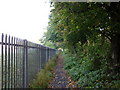
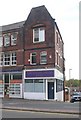
The lifestyle in LS7 1AZ is shaped by its proximity to retail and rail amenities. Within practical reach are five retail outlets, including Aldi Harehills and Morrisons Daily, offering essential shopping options. These stores cater to daily needs, though the selection is basic, reflecting the area’s small scale. The five nearby rail stations—such as Burley Park and Headingley—provide convenient access to Leeds city centre and beyond, making commuting efficient. However, the data does not mention parks, leisure facilities, or dining options, suggesting that outdoor recreation and social hubs may be limited to nearby districts. The character of LS7 1AZ is pragmatic, with residents relying on nearby infrastructure for both practical and social aspects of daily life. While the area lacks green spaces or cultural venues, its transport links and retail options ensure a functional, if unremarkable, lifestyle.
Amenities
Schools
The only school listed near LS7 1AZ is Woodside School, a special school. This means the area lacks mainstream primary or secondary schools, which could be a concern for families requiring traditional educational settings. The absence of other schools in the data suggests that residents may need to look beyond LS7 1AZ for comprehensive schooling options. Woodside School’s specific focus on special needs education indicates it serves a particular demographic, but it does not address the needs of children requiring general academic instruction. For families prioritising a range of school types, this postcode may require additional research into nearby districts. The lack of data on Ofsted ratings or school performance means potential buyers must investigate further to assess educational quality.
| Rank | School | Type | Entry gender | Ages |
|---|
Explore more schools in this area
Go to Schools tabDemographics
The community in LS7 1AZ is defined by a median age of 22, with the most common age range being adults aged 30–64. This suggests a population skewed toward working-age individuals, possibly including students or young professionals. Home ownership is exceptionally low at 10%, indicating that the majority of residents are renters. The accommodation type is predominantly flats, which aligns with the high population density. The predominant ethnic group is Black_total, highlighting the area’s demographic composition. The high population density—638,861 people per square kilometre—implies shared living spaces and potentially limited private outdoor areas. This density may influence the sense of community, with residents likely relying on nearby amenities for social interaction. However, the lack of data on deprivation levels means the quality of life cannot be fully assessed, though the rental-heavy market and flat-based housing suggest a pragmatic, urban-focused lifestyle.
Household Size
Accommodation Type
Tenure
Ethnic Group
Religion
Household Composition
Age
Household Deprivation
NS-SEC
Explore more demographic insights in this area
Go to Demographics tabPlanning
Planning Constraints
- Flood RiskPremium
- Ramsar Wetland SitesPremium
- Area of Outstanding Natural BeautyPremium
- Protected Nature ReservePremium
- Protected WoodlandPremium